
Pyrenees
Beschreibung

The Pyrenees form the natural border between Spain and france. The mountain range extends from one sea to the other, from the Atlantic to the Mediterranean, always a good excuse for hikers to symbolically cross over and stay away from home two months.
Of course there is a fan group of the Pyrenees versus one of the Alps. The Pyrenees are very different from the Alps alltogether. There are no large lakes, but many high situated small ones. There are almost no passings over the Pyrenees from France into Spain. The famous exceptions - St Jean-Pied-de-Port and Col de Somport - are used by the Way of St. James, Camino de Santiago.
There are plenty of good hikes, among them the GR10, the Haute Randonnée Pyrénéenne, and - on the Spanish side, the GR11.
Karte

Wanderwege Region
- Camino AragonésGPX
- Camino de BaztanGPX
- Camino de GironaGPX
- Camino FrancésGPX
- Carros de FocGPX
- E3GPX
- E4GPX
- E7GPX
- GR10 - Traversée des PyrénéesGPX
- GR101GPX
- GR107 - El Camí dels Bons HomesGPX
- GR11 Sendero PirenaicoGPX
- GR36 - Traversée du PérigordGPX
- GR65 - Via PodiensisGPX
- GR7GPX
- GR78 - Sentier de PiémontGPX
- GR8GPX
- GR83 - Camí del Nord o del CanigóGPX
- GR86GPX
- HRP - Haute Randonnée PyrénéenneGPX
- Sentier CathareGPX
- Tour du LarzacGPX
- Voie de Lourdes
- Voie du PiémontGPX
Links
Fakten
Berichte
Führer und Karten
Übernachtung
Organisationen
Reisebüros
GPS
Sonstiges
Bücher

United Kingdom
- Walk Together and Take Care of One Another
- Our Time on the Camino Frances Read more

United Kingdom
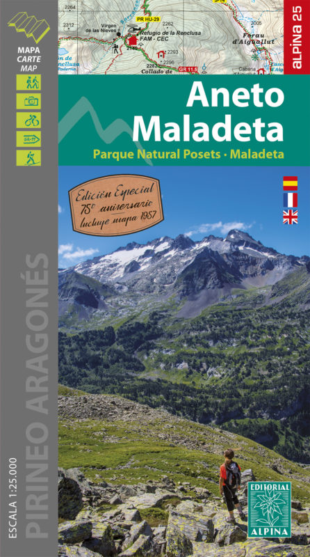
- Aneto Maladeta - PN Posets-Maladeta 2 maps
- The highest part of the Spanish Pyrenees, the Maladeta massif with Pico de Aneto including the surrounding valleys of Benasque and Barraves, at 1:25,000 on a contoured and GPS compatible map from Editorial Alpina, accompanied by a booklet with English language descriptions of recommended walks and climbs, accommodation details, etc.Vivid... Read more
- Also available from:
- De Zwerver, Netherlands
- Stanfords, United Kingdom
Netherlands
- Wandelkaart 15 Aneto - Maladeta | Editorial Alpina
- The highest part of the Spanish Pyrenees, the Maladeta massif with Pico de Aneto including the surrounding valleys of Benasque and Barraves, at 1:25,000 on a contoured and GPS compatible map from Editorial Alpina, accompanied by a booklet with English language descriptions of recommended walks and climbs, accommodation details, etc.Vivid... Read more

United Kingdom
- Aneto - Maladeta - PN Posets Editorial Alpina
- The highest part of the Spanish Pyrenees, the Maladeta massif with Pico de Aneto including the surrounding valleys of Benasque and Barraves, at 1:25,000 on a contoured and GPS compatible map from Editorial Alpina, accompanied by a booklet with English language descriptions of recommended walks and climbs, accommodation details, etc.Vivid... Read more

- Also available from:
- Stanfords, United Kingdom

United Kingdom
2021
- Volcan du Cantal et Pays de Saint-Flour - Haute-Auvergne GR400/4
- Volcan du Cantal: Pays de Saint-Flour et de Ruynes-en-Margeride, FFRP topoguide, Ref. No. 400, covering 600kms of long-distance paths in the Cantal region of the Massif Central, which can also be walked as shorter circuits. Current edition of this title was published in July 2013.To see other titles in this series please click on the series... Read more

United Kingdom
2013
- A Walk in the Clouds
- 75 short stories of adventures among the mountains of the world Read more


United Kingdom
2015
- Spain's Sendero Historico: The GR1
- Northern Spain - Picos to the Mediterranean Read more
- Also available from:
- De Zwerver, Netherlands
- Stanfords, United Kingdom

Netherlands
2015
- Wandelgids Spain's Sendero Historico: the GR1 | Cicerone
- Guidebook to the 1250km of Spain's Sendero Historico (GR1), traversing northern Spain from Puerto de Tarna in the province of Leon in the west to the Mediterranean near L'Escala in Catalonia, through fascinating, varied landscapes and the foothills of the Pyrenees. Described in 53 stages, about 25km each in length, with detailed mapping. Read more

United Kingdom
2015
- Spain`s Sendero Historico: The GR1: Northern Spain - Picos to the Mediterranean
- The Sendero Historico (the GR1) is a 1,250km long-distance path that takes you from Puerto de Tarna, on the border of Asturias and Castilla y León, east along the southern flank of the Cantabrian Mountains and the foothills of the Pyrenees before finishing on the Mediterranean coast near L`Escala.This walking guide splits the route that... Read more

- Also available from:
- De Zwerver, Netherlands


United Kingdom
- The Hairy Hikers
- A Coast-to-Coast Trek Along the French Pyrenees Read more

United Kingdom
2022
- Camino De Santiago
- SantiagoCamino Frances: St. Jean - Santiago - Finisterre Read more

United Kingdom
2023
- Also available from:
- De Zwerver, Netherlands

United Kingdom
2017
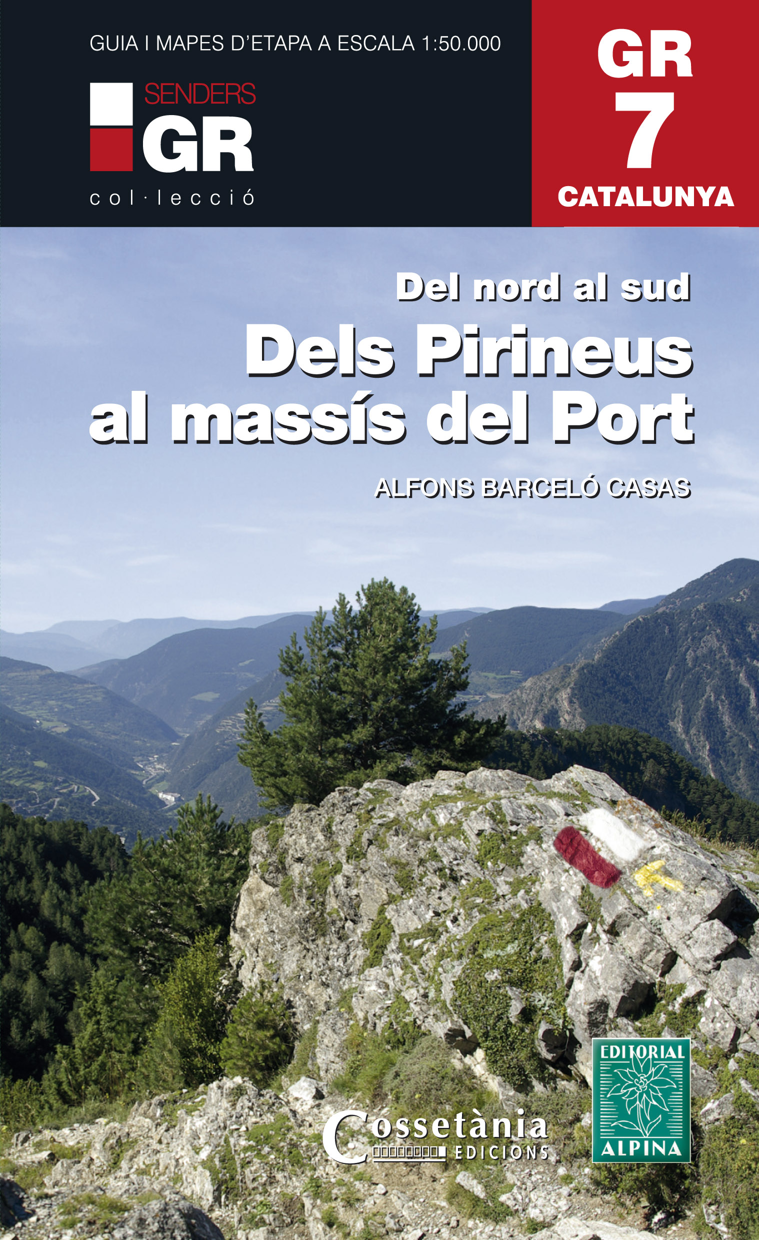
- Dels Pirineus al Massis del Port GR7 incl 15 maps
- Prachtige uitvoering van een beschrijving van de GR7 in Catalonie in 21 etappes van Porte naar Fredes, helaas wel in het Spaans. Veel details en een nauwkeurige routebeschrijving, uitgevoerd in een ringband. Nadeel is dat het een vrij zware gids is geworden. Belangrijk is echter de set losse kaarten op schaal 1:50.000; op deze topografische... Read more
- Also available from:
- De Zwerver, Netherlands
Netherlands
2017
- Wandelgids GR 7 Catalunya - dels Pirineus al Massís del Port : Del nord al sud | Editorial Alpina
- Prachtige uitvoering van een beschrijving van de GR7 in Catalonie in 21 etappes van Porte naar Fredes, helaas wel in het Spaans. Veel details en een nauwkeurige routebeschrijving, uitgevoerd in een ringband. Nadeel is dat het een vrij zware gids is geworden. Belangrijk is echter de set losse kaarten op schaal 1:50.000; op deze topografische... Read more

United Kingdom
2021
- Also available from:
- De Zwerver, Netherlands
- Stanfords, United Kingdom

United Kingdom
2021
- Tour du Cotentin - Littorral de la Normandie GR223
- Tour du Cotentin, FFRP topoguide Ref. no. 200, covering the GR223 along the coast of the Cotentin Peninsula from Isigny-sur-Mer to Mont-St-Michel, including the Utah Beach of the D-Day Normandy Landings. Together with several variants off the main route, the guide provides coverage of nearly 600kms of hiking trails. Current edition of this... Read more

United Kingdom
2021
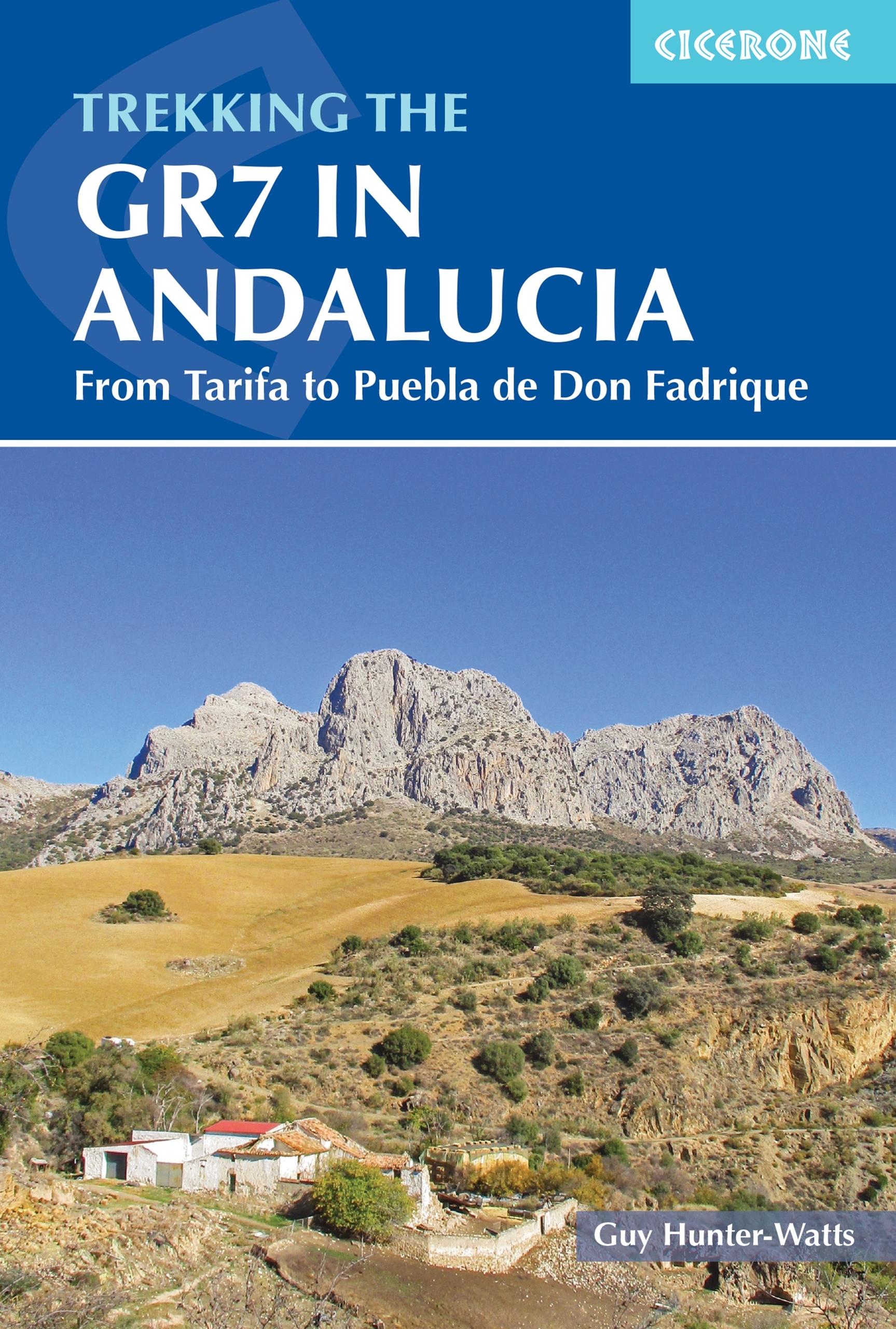
- Trekking the GR7 in Andalucia
- From Tarifa to Puebla de Don Fadrique Read more
- Also available from:
- De Zwerver, Netherlands
Netherlands
2021
- Wandelgids Walking the GR7 in Andalucia | Cicerone
- From Tarifa to Puebla de Don Fadrique Read more

United Kingdom
2023
- A Pilgrim's Guide to the Camino De Santiago
- Camino Frances St. Jean Pied De Port - Santiago Read more
Karten

United Kingdom
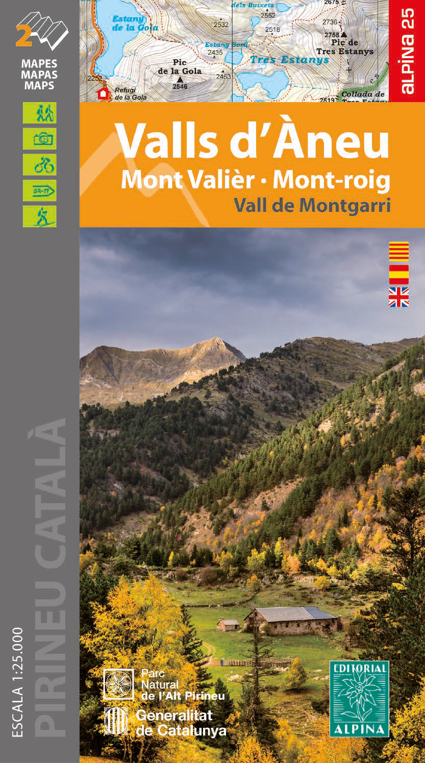
- Valls d'Aneu - Mont Valier - Mont-roig / Vall de Montgarri
- •Hiking map and guidebook•Scale 1:25.000•Equidistance contours: 10 m distance•Master contours: at 50 m•Shady relief•Compatible with GPS•Marked routes•Land use symbolized at three levels•Guidebook with hikes, potholing, gully descent, climbing, mountain biking and all the facts of interest Read more
- Also available from:
- De Zwerver, Netherlands
- Stanfords, United Kingdom
Netherlands
- Wandelkaart 25 Valls d'Àneu | Editorial Alpina
- •Hiking map and guidebook•Scale 1:25.000•Equidistance contours: 10 m distance•Master contours: at 50 m•Shady relief•Compatible with GPS•Marked routes•Land use symbolized at three levels•Guidebook with hikes, potholing, gully descent, climbing, mountain biking and all the facts of interest Read more

United Kingdom
- Valls d’Àneu - Mont Valier - Mont-roig - Vall de Montgarri Editorial Alpina 2-Map Set
- •Hiking map and guidebook•Scale 1:25.000•Equidistance contours: 10 m distance•Master contours: at 50 m•Shady relief•Compatible with GPS•Marked routes•Land use symbolized at three levels•Guidebook with hikes, potholing, gully descent, climbing, mountain biking and all the facts of interest Read more

United Kingdom
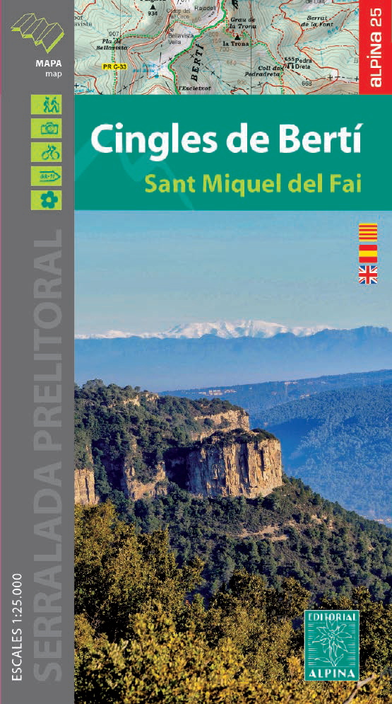
- Cingles del Berti - Sant Miquel des Fai
- Cingles de Berti area at 1:25,000 in an extensive and very popular series of walking maps from Editorial Alpina. Contours are at 10m intervals, enhanced by relief shading and vegetation colouring. The map has UTM grid and 1’ margin ticks. In addition to footpaths, the overprint shows various types of accommodation (hotels, campsites, etc.),... Read more
- Also available from:
- De Zwerver, Netherlands
- Stanfords, United Kingdom
Netherlands
- Wandelkaart 54 Cingles de Berti | Editorial Alpina
- Cingles de Berti area at 1:25,000 in an extensive and very popular series of walking maps from Editorial Alpina. Contours are at 10m intervals, enhanced by relief shading and vegetation colouring. The map has UTM grid and 1’ margin ticks. In addition to footpaths, the overprint shows various types of accommodation (hotels, campsites, etc.),... Read more

United Kingdom
- Cingles de Berti - Sant Miquel des Fai Editorial Alpina
- Cingles de Berti area at 1:25,000 in an extensive and very popular series of walking maps from Editorial Alpina. Contours are at 10m intervals, enhanced by relief shading and vegetation colouring. The map has UTM grid and 1’ margin ticks. In addition to footpaths, the overprint shows various types of accommodation (hotels, campsites, etc.),... Read more

United Kingdom
- Alpes du Sud
- Pyrénées Ouest map from the IGN at 1:200,000, with excellent presentation of the terrain through contours and vivid relief shading, plenty of names of topographic features, long-distance GR hiking routes, places of interest, etc. The map is designed to provide convenient coverage of the western and central part of the Pyrenees, extending across... Read more
- Also available from:
- Stanfords, United Kingdom

United Kingdom
- Southern Alps IGN Top200 203
- Pyrénées Ouest map from the IGN at 1:200,000, with excellent presentation of the terrain through contours and vivid relief shading, plenty of names of topographic features, long-distance GR hiking routes, places of interest, etc. The map is designed to provide convenient coverage of the western and central part of the Pyrenees, extending across... Read more

United Kingdom
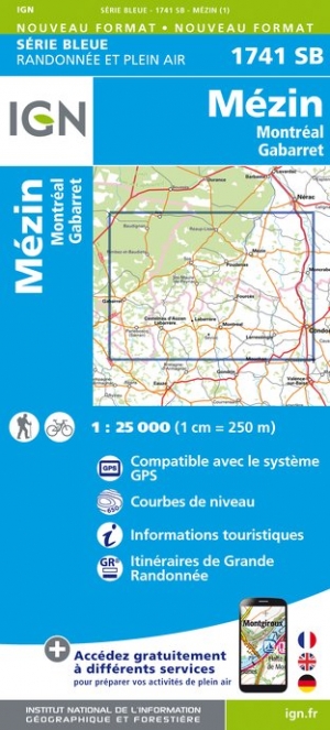
- Mezin / Montreal / Gabarret
- Topographic survey of France at 1:25,000 in IGN`s excellent TOP25 / S�rie Bleue series. All the maps are GPS compatible, with a 1km UTM grid plus latitude and longitude lines at 5� intervals. Contours are at 5m intervals except for mountainous areas where the maps have contours at 10m intervals, vividly enhanced by hill shading and graphics for ... Read more
- Also available from:
- De Zwerver, Netherlands
- Stanfords, United Kingdom
Netherlands
- Wandelkaart - Topografische kaart 1741SB Mézin | IGN - Institut Géographique National
- Topographic survey of France at 1:25,000 in IGN`s excellent TOP25 / S�rie Bleue series. All the maps are GPS compatible, with a 1km UTM grid plus latitude and longitude lines at 5� intervals. Contours are at 5m intervals except for mountainous areas where the maps have contours at 10m intervals, vividly enhanced by hill shading and graphics for ... Read more

United Kingdom
- Mezin - Montreal - Gabarret IGN 1741SB
- Topographic survey of France at 1:25,000 in IGN`s excellent TOP25 / Série Bleue series. All the maps are GPS compatible, with a 1km UTM grid plus latitude and longitude lines at 5’ intervals. Contours are at 5m intervals except for mountainous areas where the maps have contours at 10m intervals, vividly enhanced by hill shading and graphics for... Read more

- Also available from:
- De Zwerver, Netherlands
- Stanfords, United Kingdom

Netherlands
United Kingdom
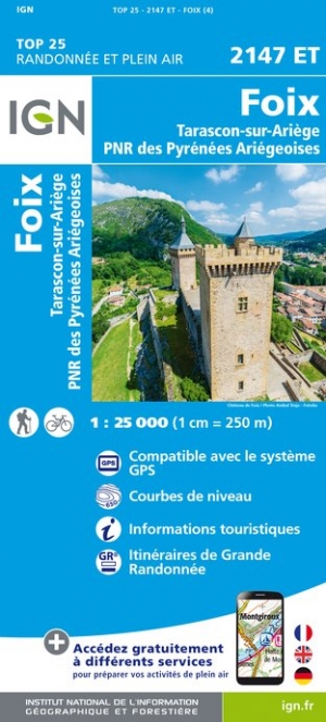
- Foix - Tarascon-sur-Ariege - PNR des Pyrenees Ariegeoises IGN 2147ET
- Topographic survey of France at 1:25,000 in IGN`s excellent TOP25 / Série Bleue series. All the maps are GPS compatible, with a 1km UTM grid plus latitude and longitude lines at 5’ intervals. Contours are at 5m intervals except for mountainous areas where the maps have contours at 10m intervals, vividly enhanced by hill shading and graphics for... Read more

United Kingdom
2021
- Le long des ch�teaux de la Loire GR3/GR3B
- Le long des Châteaux de la Loire, FFRP topoguide Ref. No. 333, covering 552km route along the Loire from Bonny-sur-Loire across Orléans, Blois and Tours to Angers. Current edition of this title was published in May 2018.The Loire is world famous for its castles and gardens, now classified as World Heritage by UNESCO. The site of the Loire... Read more
- Also available from:
- Stanfords, United Kingdom
United Kingdom
2021
- Le long des Chateaux de la Loire GR3/GR3B
- Le long des Châteaux de la Loire, FFRP topoguide Ref. No. 333, covering 552km route along the Loire from Bonny-sur-Loire across Orléans, Blois and Tours to Angers. Current edition of this title was published in May 2018.The Loire is world famous for its castles and gardens, now classified as World Heritage by UNESCO. The site of the Loire... Read more

United Kingdom
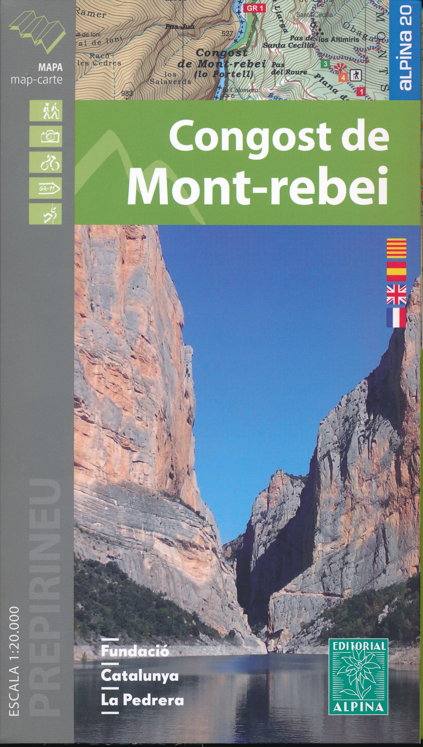
- Mont-rebei congost de
- Congost de Mont-rebei in an extensive and very popular series of walking maps from Editorial Alpina covering the Pyrenees, Catalonia and other selected hiking areas in Spain, including Picos de Europa, Sierra Nevada and parts of Andalucía, Majorca, etc. Scales vary from 1:50,000 to 1:10,000, with the majority of the titles at 1:25,000. The... Read more
- Also available from:
- De Zwerver, Netherlands
- Stanfords, United Kingdom
Netherlands
- Wandelkaart 33 Congost de Mont-rebei | Editorial Alpina
- Congost de Mont-rebei in an extensive and very popular series of walking maps from Editorial Alpina covering the Pyrenees, Catalonia and other selected hiking areas in Spain, including Picos de Europa, Sierra Nevada and parts of Andalucía, Majorca, etc. Scales vary from 1:50,000 to 1:10,000, with the majority of the titles at 1:25,000. The... Read more

United Kingdom
- Congost de Mont-rebei Editorial Alpina
- Congost de Mont-rebei in an extensive and very popular series of walking maps from Editorial Alpina covering the Pyrenees, Catalonia and other selected hiking areas in Spain, including Picos de Europa, Sierra Nevada and parts of Andalucía, Majorca, etc. Scales vary from 1:50,000 to 1:10,000, with the majority of the titles at 1:25,000. The... Read more

- Also available from:
- De Zwerver, Netherlands
- Stanfords, United Kingdom
Netherlands

United Kingdom
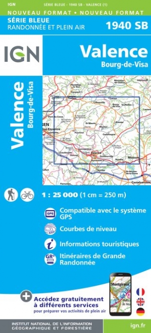
- Valence - Bourg-de-Visa IGN 1940SB
- Topographic survey of France at 1:25,000 in IGN`s excellent TOP25 / Série Bleue series. All the maps are GPS compatible, with a 1km UTM grid plus latitude and longitude lines at 5’ intervals. Contours are at 5m intervals except for mountainous areas where the maps have contours at 10m intervals, vividly enhanced by hill shading and graphics for... Read more

- Also available from:
- De Zwerver, Netherlands
- Stanfords, United Kingdom
Netherlands

United Kingdom
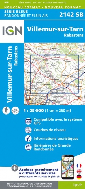
- Villemur-sur-Tarn - Rabastens IGN 2142SB
- Topographic survey of France at 1:25,000 in IGN`s excellent TOP25 / Série Bleue series. All the maps are GPS compatible, with a 1km UTM grid plus latitude and longitude lines at 5’ intervals. Contours are at 5m intervals except for mountainous areas where the maps have contours at 10m intervals, vividly enhanced by hill shading and graphics for... Read more

United Kingdom

United Kingdom
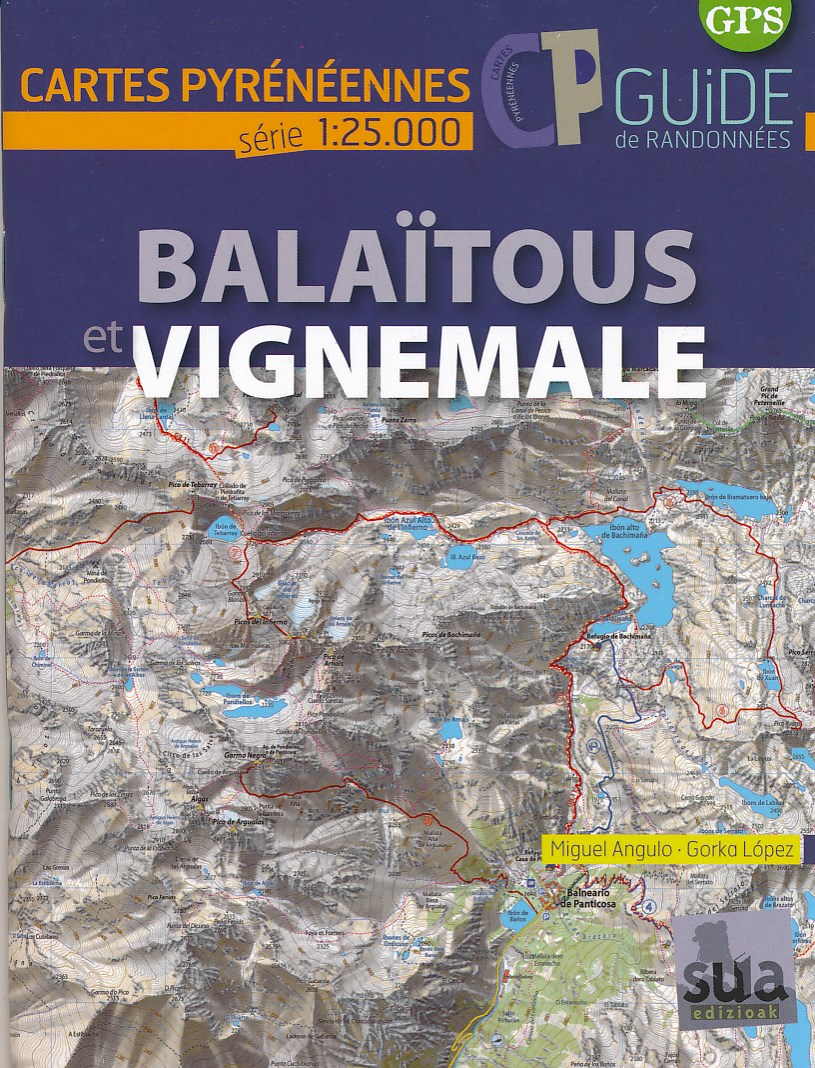
- Balaïtous et Vignemale
- Mooie bijzonder gedetailleerde wandelkaart van een klein deel van de Pyreneeen. De wandelroutes zijn ingetekend, ook zijn met symbolen veel praktische zaken weergegeven als campings, hutten maar ook opvallende aspecten in het landschap. In de (Franstalige) gids vindt u vijftien routes met betrekking tot wandelen, fietsen en klimmen in de... Read more
- Also available from:
- De Zwerver, Netherlands
Netherlands
- Wandelkaart Balaïtous - Vignemale | Sua edizioak
- Mooie bijzonder gedetailleerde wandelkaart van een klein deel van de Pyreneeen. De wandelroutes zijn ingetekend, ook zijn met symbolen veel praktische zaken weergegeven als campings, hutten maar ook opvallende aspecten in het landschap. In de (Franstalige) gids vindt u vijftien routes met betrekking tot wandelen, fietsen en klimmen in de... Read more

United Kingdom
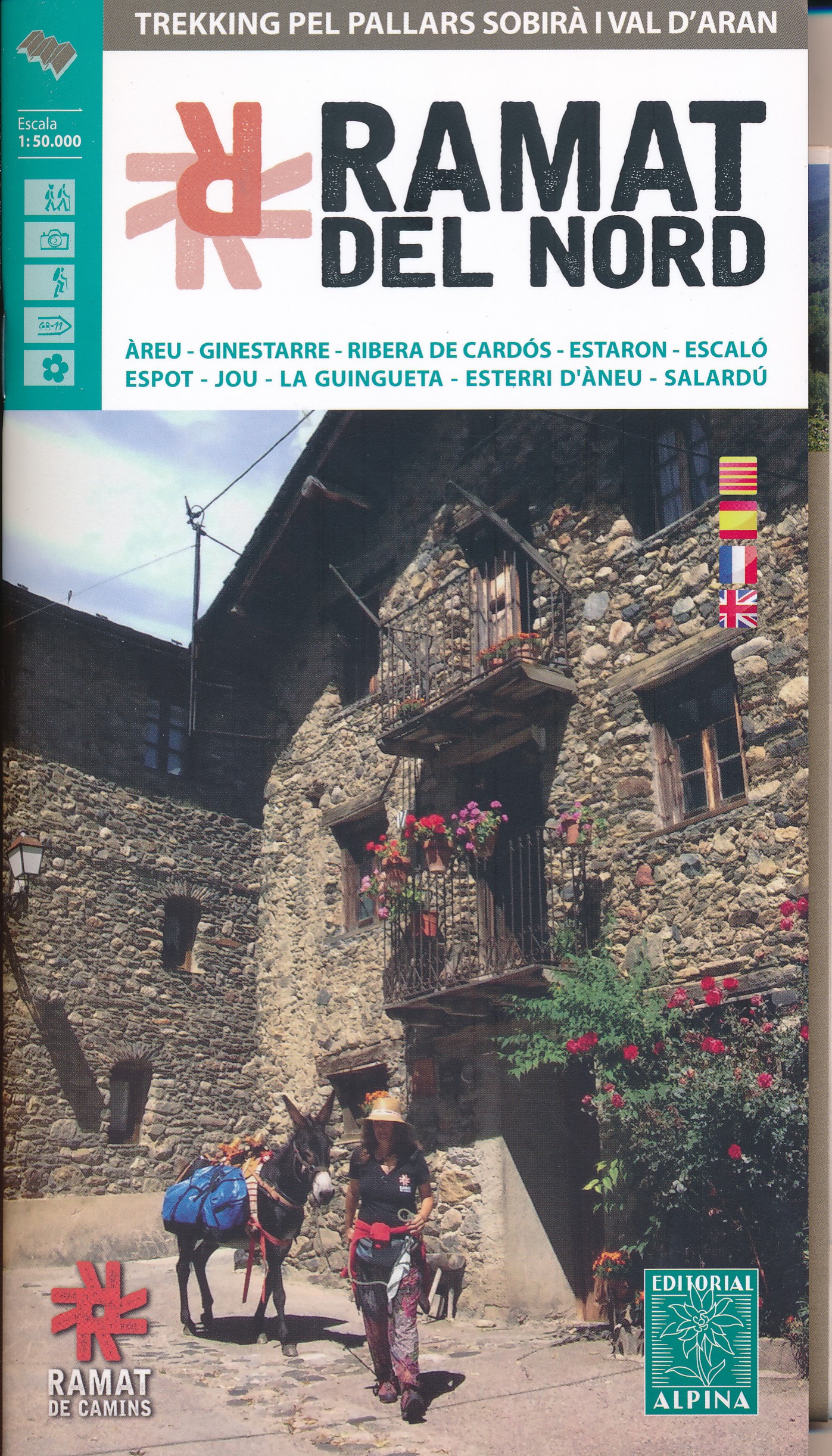
- Ramat del Nord trekking map & guide
- Trekking through the Pallars following in the footsteps of Camilo Jose Cela and Josep M. Espinas. This Editorial Alpina map and guide at 1:50,000 scale is in English, French, Spanish and Catalan.Covers: La Pobla de Segur, Peramea, Gerri de la Sal, Baro, Tornafort, Sort, Llessui, Rialp, Llavorsi, Tirvia, Areu. Read more
- Also available from:
- De Zwerver, Netherlands
- Stanfords, United Kingdom
Netherlands
- Wandelkaart Ramat del Nord | Editorial Alpina
- Trekking through the Pallars following in the footsteps of Camilo Jose Cela and Josep M. Espinas. This Editorial Alpina map and guide at 1:50,000 scale is in English, French, Spanish and Catalan.Covers: La Pobla de Segur, Peramea, Gerri de la Sal, Baro, Tornafort, Sort, Llessui, Rialp, Llavorsi, Tirvia, Areu. Read more

United Kingdom
- Ramat del Nord Editorial Alpina
- Trekking through the Pallars following in the footsteps of Camilo Jose Cela and Josep M. Espinas. This Editorial Alpina map and guide at 1:50,000 scale is in English, French, Spanish and Catalan.Covers: La Pobla de Segur, Peramea, Gerri de la Sal, Baro, Tornafort, Sort, Llessui, Rialp, Llavorsi, Tirvia, Areu. Read more

- Also available from:
- De Zwerver, Netherlands

- Also available from:
- De Zwerver, Netherlands
- Stanfords, United Kingdom
Netherlands

United Kingdom
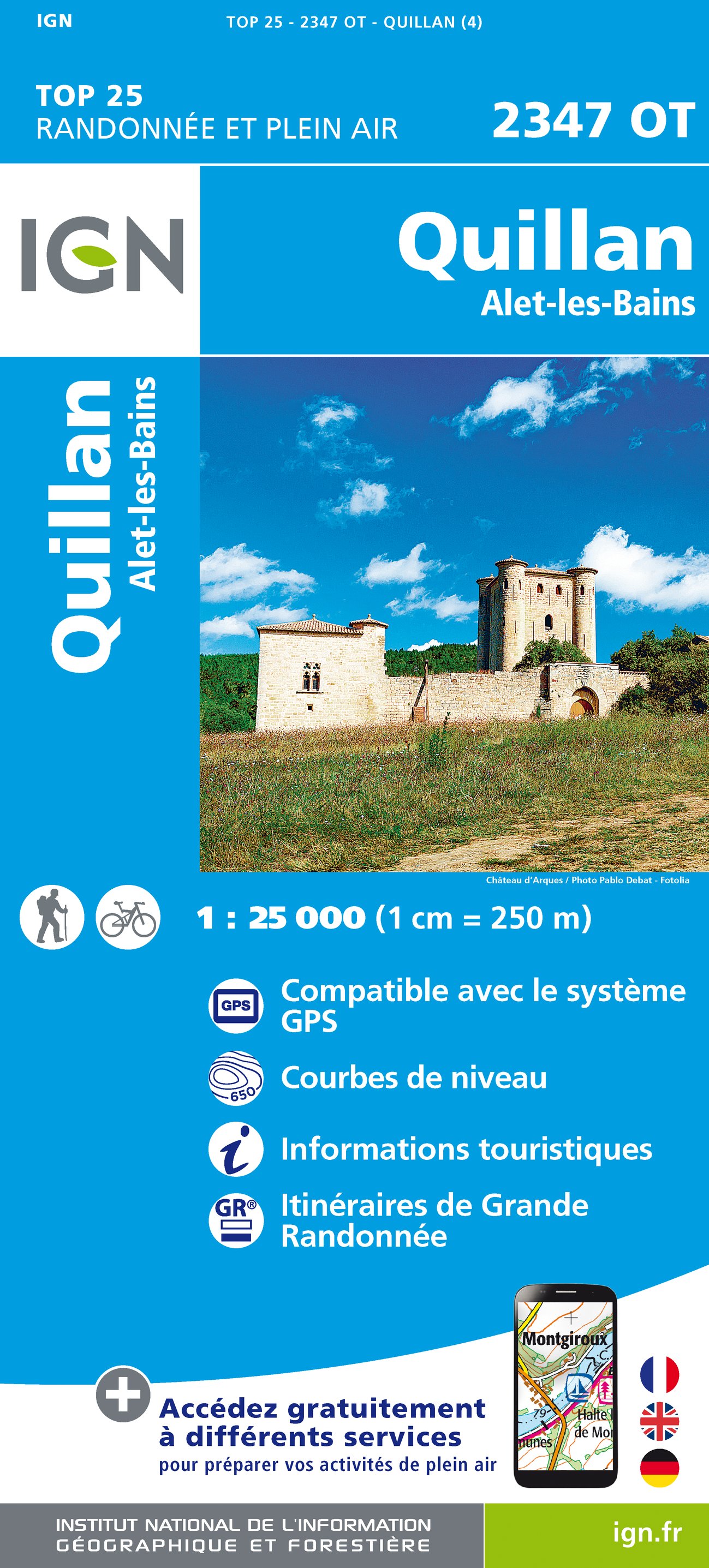
- Quillan - Alet-les-Bains IGN 2347OT
- Topographic survey of France at 1:25,000 in IGN`s excellent TOP25 / Série Bleue series. All the maps are GPS compatible, with a 1km UTM grid plus latitude and longitude lines at 5’ intervals. Contours are at 5m intervals except for mountainous areas where the maps have contours at 10m intervals, vividly enhanced by hill shading and graphics for... Read more

- Also available from:
- Stanfords, United Kingdom

United Kingdom
- Ordesa and Monte Perdido National Park Editorial Alpina
- Ordesa and Monte Perdido National Park at 1:40,000 on a GPS compatible recreational map in an extensive and very popular series from Editorial Alpina, including a booklet with English language descriptions of several walks, climbs, etc.Contours are at 20m intervals, with relief shading and altitude colouring. An overprint highlights waymarked... Read more