
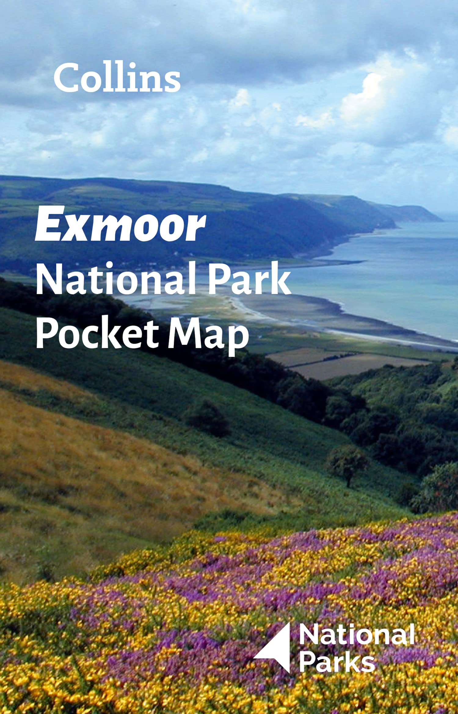
Exmoor
Beschreibung
Exmoor National Park is located in southwest England, and is divided between the counties Somerset and Devon.
Exmoor is very different from the other main park in Devon: Dartmoor. Dartmoor is empty, infertile, very wet. Exmoor National Park on the other hand has a diverse nature, including farmlands, woods, small hamlets some of the wildest coastline in England, ánd moorland.
Wanderwege Region
Links
Fakten
Berichte
Führer und Karten
Übernachtung
Organisationen
Reisebüros
GPS
Sonstiges
Bücher

- Also available from:
- Stanfords, United Kingdom

Stanfords
United Kingdom
United Kingdom
- Short Walks Exmoor: Leisure Walks for All Ages
- Exmoor consists of wide expanses of heather and rich woodland all of which are greatly enhanced by its varied wildlife. It has the West Country`s largest population of red deer, which frequent its woodland and moors and yet it remains less visited and less popular than the two other great uplands of south-west England - Dartmoor and Bodmin... Read more

- Also available from:
- Stanfords, United Kingdom

Stanfords
United Kingdom
United Kingdom
- Torquay & Dawlish - Newton Abbot OS Explorer Active Map OL44 (waterproof)
- Torquay and Dawlish area of south Devon on a detailed topographic and GPS compatible map OL44, waterproof version, from the Ordnance Survey’s 1:25,000 Explorer series. Coverage extends from the Exe Estuary in the north-east to Totnes in the south-west and includes Paignton, Newton Abbot, Teignmouth, Exminster, Bovey Tracy, Trenchford Reservoir,... Read more

The Book Depository
United Kingdom
2018
United Kingdom
2018
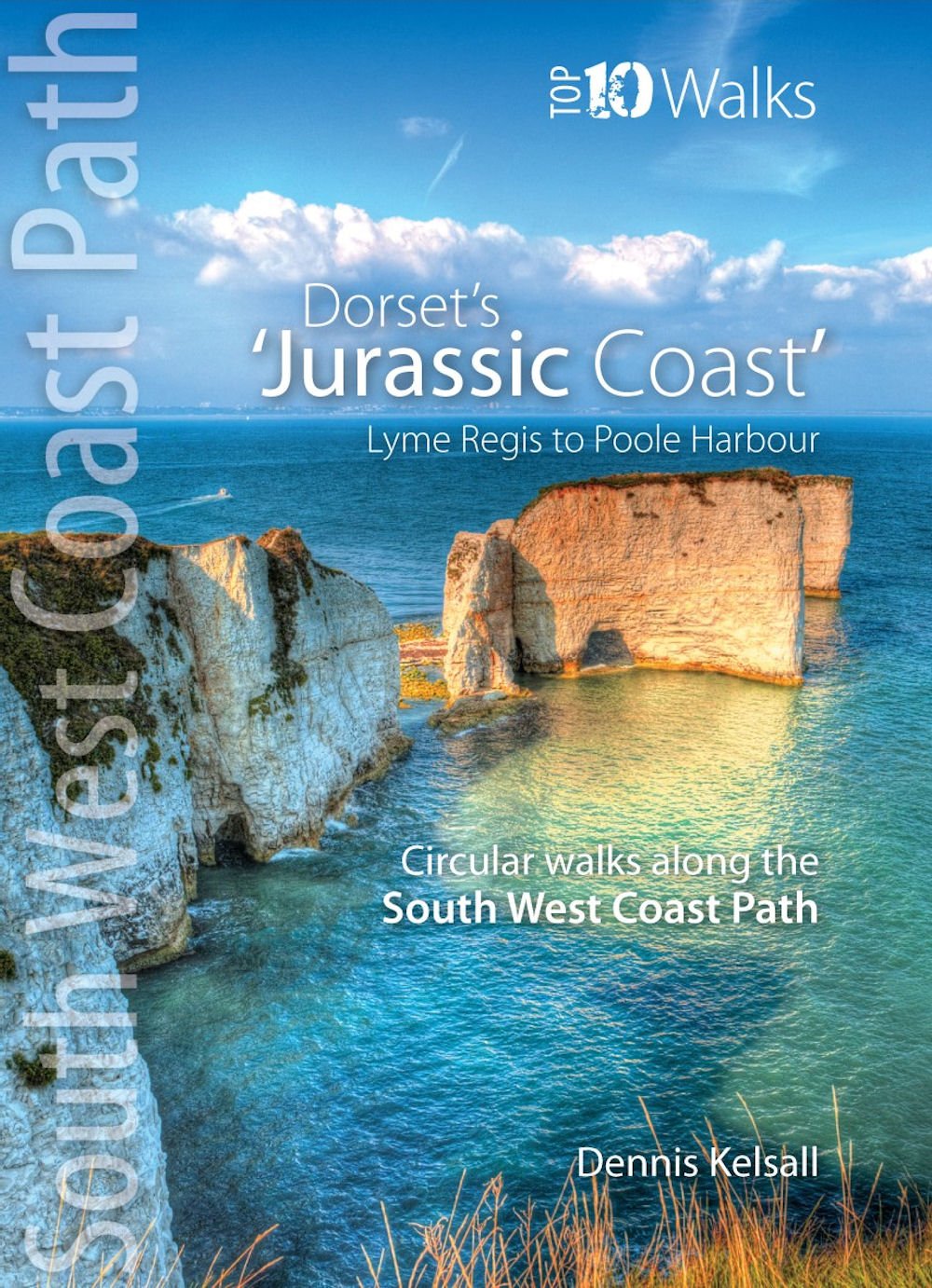
- The Jurassic Coast (Lyme Regis to Poole Harbour)
- Circular Walks along the South West Coast Path Read more
- Also available from:
- De Zwerver, Netherlands
- Stanfords, United Kingdom
De Zwerver
Netherlands
2018
Netherlands
2018
- Wandelgids The Jurassic Coast | Northern Eye Books
- Circular Walks along the South West Coast Path Read more

Stanfords
United Kingdom
2018
United Kingdom
2018
- The Jurassic Coast - Lyme Regis to Poole Harbour - Classic Walks - South West Coast Path
- The ten best circular walks on the coast between Lyme Regis and Studland Bay. highlights include, Durdle Door, Lulworth Cove and Old Harry Rocks. Read more

The Book Depository
United Kingdom
2022
United Kingdom
2022
- Cornwall Coast Path (Trailblazer British Walking guides) SW Coast Path Part 2 - Bude to Plymouth
- Includes 142 Large-Scale Walking Maps (1:20,000) & Guides to 81 Towns and Villages - Planning, Places to Stay, Places to Eat Read more
- Also available from:
- De Zwerver, Netherlands
- Stanfords, United Kingdom

De Zwerver
Netherlands
2022
Netherlands
2022
- Wandelgids Cornwall Coast Path | Trailblazer Guides
- Practical, complete hiking route guide, with maps and accommodation for the 288-mile footpath that runs around the entire coastline of Cornwall, from Bude to Plymouth; Part 2 of the South-West-Coast Path, a 630-mile National Trail from Minehead to Poole. Includes * 142 large-scale walking maps in TWO-COLOUR style (3 1/8inches to 1 mile), 15 ... Read more

Stanfords
United Kingdom
2022
United Kingdom
2022
- Cornwall Coast Path - Bude to Plymouth (Book 2) 7
- Practical, complete hiking route guide, with maps and accommodation for the 288-mile footpath that runs around the entire coastline of Cornwall, from Bude to Plymouth; Part 2 of the South-West-Coast Path, a 630-mile National Trail from Minehead to Poole. Includes * 142 large-scale walking maps in TWO-COLOUR style (3 1/8inches to 1 mile), 15 ... Read more

- Also available from:
- Stanfords, United Kingdom

Stanfords
United Kingdom
United Kingdom
- Minehead, Brendon Hills, Dulverton & Tiverton OS Landranger Active Map 181 (waterproof)
- Minehead with the eastern part of the Exmoor National Park including Brendon Hills, on a waterproof and tear-resistant OS Active version of map No. 181 from the Ordnance Survey’s Landranger series at 1:50,000, with contoured and GPS compatible topographic mapping plus tourist information.MOBILE DOWNLOADS: As well as the physical edition of the... Read more


The Book Depository
United Kingdom
2018
United Kingdom
2018
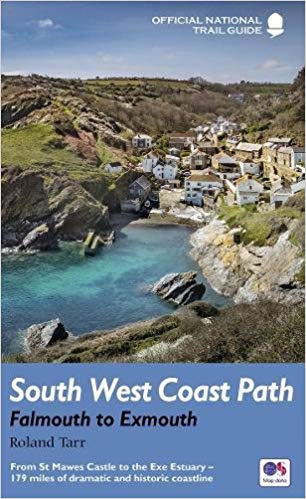
- South West Coast Path: Falmouth to Exmouth
- From St Mawes Castle to the Exe Estuary - 179 miles of dramatic and historic coastline Read more
- Also available from:
- De Zwerver, Netherlands
De Zwerver
Netherlands
2018
Netherlands
2018
- Wandelgids 10 The South West Coast Path National Trail Guide | Aurum Press
- Falmouth to Exmouth: National Trail Guide Read more

- Also available from:
- De Zwerver, Netherlands
- Stanfords, United Kingdom

De Zwerver
Netherlands
Netherlands

Stanfords
United Kingdom
United Kingdom
- Exeter, Sidmouth, Exmouth & Teignmouth OS Landranger Map 192 (paper)
- Exeter and Sidmouth area, including a section of the South West Coast Path / E9 European Long-distance Path, on a paper version of map No. 192 from the Ordnance Survey’s Landranger series at 1:50,000, with contoured and GPS compatible topographic mapping plus tourist information.MOBILE DOWNLOADS: As well as the physical edition of the map, each... Read more

The Book Depository
United Kingdom
United Kingdom
- North Cornwall Coast
- Bude to Land's End - Circular Walks along the South West Coast Path Read more
- Also available from:
- Stanfords, United Kingdom

Stanfords
United Kingdom
United Kingdom
- North Cornwall Coast: Bude to Land`s End - Circular Walks along the South West Coast Path
- These attractive and cleverly structured guides will give walkers ten of the best short circular walks along each of the five sections of the 630-mile long South West Coast Path in a popular pocket-size format.With clear information, an overview and introduction for each walk, expertly written numbered directions, large scale Ordnance Survey... Read more

The Book Depository
United Kingdom
2021
United Kingdom
2021
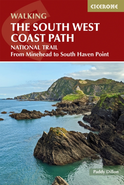
- Walking the South West Coast Path
- National Trail From Minehead to South Haven Point Read more
- Also available from:
- De Zwerver, Netherlands

- Also available from:
- Stanfords, United Kingdom

Stanfords
United Kingdom
United Kingdom
- Bude, Clovelly, Boscastle & Holsworthy OS Landranger Active Map 190 (waterproof)
- Bude and Clovelly area, including a section of the South West Coast Path, on a waterproof and tear-resistant OS Active version of map No. 190 from the Ordnance Survey’s Landranger series at 1:50,000, with contoured and GPS compatible topographic mapping plus tourist information.MOBILE DOWNLOADS: As well as the physical edition of the map, each... Read more


The Book Depository
United Kingdom
2013
United Kingdom
2013
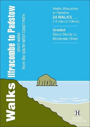
- Walks Ilfracombe to Padstow
- Short Walks from the South West Coast Path Read more
- Also available from:
- De Zwerver, Netherlands
De Zwerver
Netherlands
2013
Netherlands
2013
- Wandelgids Ilfracombe to Padstow | Hallewell Publications
- Short Walks from the South West Coast Path Read more

The Book Depository
United Kingdom
2019
United Kingdom
2019
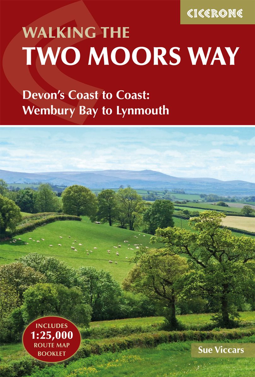
- The Two Moors Way
- Devon's Coast to Coast: Wembury Bay to Lynmouth Read more
- Also available from:
- De Zwerver, Netherlands
- Stanfords, United Kingdom
De Zwerver
Netherlands
2019
Netherlands
2019
- Wandelgids The Two Moors Way | Cicerone
- Guidebook to walking Devon's Coast to Coast, a 117 mile route incorporating the Two Moors Way and a section of the Erme-Plym Trail. Beginning at Wembury Bay on the south coast and finishing at Lynmouth, the walk passes through the beautiful countryside of Dartmoor and Exmoor. A map booklet of the full route on OS 1:25K maps is included. Read more

Stanfords
United Kingdom
2019
United Kingdom
2019
- The Two Moors Way: Devon`s Coast to Coast: Wembury Bay to Lynmouth
- This guidebook to walking Coast to Coast across Devon, presents a 117 mile route incorporating the Two Moors Way and a section of the Erme-Plym Trail. Beginning at Wembury Bay on the south coast and finishing at Lynmouth, the 11-stage walk passes through the beautiful Devon countryside and across two of southwest England`s magnificent... Read more
Karten

- Also available from:
- Stanfords, United Kingdom

Stanfords
United Kingdom
United Kingdom
- Exmoor AA Walker`s Map 13
- Exmoor at 1:25,000 in a series of Walker’s Maps published by the AA with the cartography from the Ordnance Survey’s Explorer series. The map is double-sided and coverage includes the Exmoor National Park, Ilfracombe, Combe Martin, Lynton, Porlock, Minehead, Williton, Exford, Dulverton, Brayford, Barnstaple, etc.Maps in the AA Walker’s series... Read more

Stanfords
United Kingdom
United Kingdom
- Minehead and Brendon Hills 1919
- Map No. 181, Minehead and Brendon Hills 1919, in the Cassini Historical Series of old Ordnance Survey mapping of England and Wales at 1:50,000 in a format designed to offer a convenient comparison with the present day coverage from the OS, and most locations in three different editions. Old historical maps have been combined so that the sheet... Read more
Stanfords
United Kingdom
United Kingdom
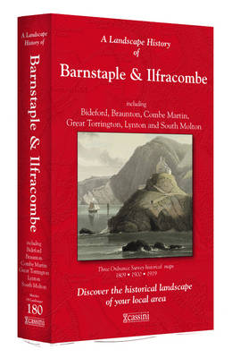
- Barnstaple and Ilfracombe 1809
- Map No. 180, Barnstaple and Ilfracombe 1809, in the Cassini Historical Series of old Ordnance Survey mapping of England and Wales at 1:50,000 in a format designed to offer a convenient comparison with the present day coverage from the OS, and most locations in three different editions. Old historical maps have been combined so that the sheet... Read more
Stanfords
United Kingdom
United Kingdom
- Minehead and Brendon Hills 1898-1900
- Map No. 181, Minehead and Brendon Hills 1898-1900, in the Cassini Historical Series of old Ordnance Survey mapping of England and Wales at 1:50,000 in a format designed to offer a convenient comparison with the present day coverage from the OS, and most locations in three different editions. Old historical maps have been combined so that the... Read more
Stanfords
United Kingdom
United Kingdom
- Barnstaple and Ilfracombe 1919
- Map No. 180, Barnstaple and Ilfracombe 1919, in the Cassini Historical Series of old Ordnance Survey mapping of England and Wales at 1:50,000 in a format designed to offer a convenient comparison with the present day coverage from the OS, and most locations in three different editions. Old historical maps have been combined so that the sheet... Read more

Stanfords
United Kingdom
United Kingdom
- Minehead and Brendon Hills 1809- 1919 (3-map set)
- Map No. 181, Minehead and Brendon Hills 1919, in the Cassini Historical Series of old Ordnance Survey mapping of England and Wales at 1:50,000 in a format designed to offer a convenient comparison with the present day coverage from the OS, and most locations in three different editions. Old historical maps have been combined so that the sheet... Read more
Stanfords
United Kingdom
United Kingdom
- Barnstaple and Ilfracombe 1900
- Map No. 180, Barnstaple and Ilfracombe 1900, in the Cassini Historical Series of old Ordnance Survey mapping of England and Wales at 1:50,000 in a format designed to offer a convenient comparison with the present day coverage from the OS, and most locations in three different editions. Old historical maps have been combined so that the sheet... Read more

Stanfords
United Kingdom
United Kingdom
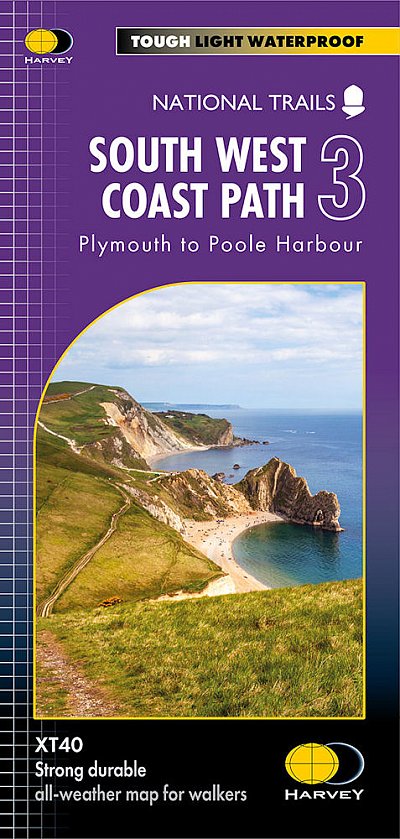
- Two Moors Way Harvey National Trail XT40
- Two Moors Way, a 150km / 93 mile long-distance trail between Lynmouth on the north coast of Devon and Ivybridge near Plymouth, crossing Exmoor and Dartmoor National Parks, presented at 1:40,000 on a light, waterproof and tear-resistant map from Harvey Map Services. The route is shown on six panels.Maps in the Harvey’s series covering Great... Read more
Stanfords
United Kingdom
United Kingdom
- Barnstaple and Ilfracombe 1809-1919 (3-map set)
- Map No. 180, Barnstaple and Ilfracombe 1809-1919 (3-map set), in the Cassini Historical Series of old Ordnance Survey mapping of England and Wales at 1:50,000 in a format designed to offer a convenient comparison with the present day coverage from the OS, and most locations in three different editions. Old historical maps have been combined so... Read more

Stanfords
United Kingdom
2015
United Kingdom
2015
- South West Coast Path 5 - Dorset A-Z Adventure Atlas
- South West Coast Path 5 - Dorset Adventure Atlas at 1:25,000 in a series of handy A5 size Adventure Atlases from Geographers` A-Z Map Company with cartography from the Ordnance Survey’s Explorer series. The guide covers the 138 km / 86 mile section of the SWCP National Trail between Lyme Regis and Poole and includes a route planner indicating... Read more

Stanfords
United Kingdom
United Kingdom
- Exmoor & Taunton Cycling Map 84
- Exmoor and Taunton area of Devon and Somerset at 1:100,000 on a handy size, 50x35cm, double-sided contoured map from Croydecycle, printed on waterproof and tear-resistant synthetic paper and showing National Cycle routes and numerous local facilities, including campsites, pubs, etc. Coverage extends from Combe Martin, Barnstaple and South... Read more

Stanfords
United Kingdom
United Kingdom
- Exmoor A-Z Adventure Atlas
- Exmoor at 1:25,000 in a series of handy A5 size Adventure Atlases from Geographers` A-Z Map Company with cartography from the Ordnance Survey’s Explorer series. Coverage includes the South West Coast path between Minehead and Combe Martin Bay, Two Moors Way, Tarka Train, Dulverton, Brendon Hills, etc.To see other titles in this series please... Read more