
North York Moors
Beschreibung
The North York Morks is a national park, located in northeastern England, along the Northsea coast. It is one of the largest expances of open heather moorland in the UK. There are a great many footpaths and rights of way in the park. The well known Coast to Coast walk goes through the heart of the moors. The Cleveland way touches the northern edge of the area.
A popular challenge is the Lyke Wake Walk, a complete crossing of the North Yorkshire moors over a length of 40 miles in less than 24 hours.
Wanderwege Region
Links
Fakten
Berichte
Führer und Karten
Übernachtung
Organisationen
Reisebüros
GPS
Sonstiges
Bücher


- Also available from:
- Stanfords, United Kingdom

Stanfords
United Kingdom
United Kingdom
- North York Moors
- This new title is one of the first two in an updated series of Paul Hannon`s `Short Scenic Walks` guidebooks. The principle feature is that all walks are less than five miles in length, offering a perfect half day`s stroll for families, casual walkers and all who want to enjoy a leisurely exploration of Britain`s outstanding country landscapes.... Read more


- Also available from:
- Stanfords, United Kingdom

Stanfords
United Kingdom
United Kingdom
- Canterbury, East Kent, Dover & Margate OS Landranger Active Map 179 (waterproof)
- Eastern Kent with Canterbury, Dover and Margate, including sections of the North Downs Way and the E2 and E9 European Long-Distance Paths, on a waterproof and tear-resistant OS Active version of map No. 179 from the Ordnance Survey’s Landranger series at 1:50,000, with contoured and GPS compatible topographic mapping plus tourist... Read more

- Also available from:
- De Zwerver, Netherlands
De Zwerver
Netherlands
2023
Netherlands
2023

- Also available from:
- Stanfords, United Kingdom

Stanfords
United Kingdom
United Kingdom
- Dorking, Reigate, Crawley & Horsham OS Landranger Active Map 187 (waterproof)
- Dorking and Reigate area, including a section of the North Downs Way / E2 European Long-distance Path, on a waterproof and tear-resistant OS Active version of map No. 187 from the Ordnance Survey’s Landranger series at 1:50,000, with contoured and GPS compatible topographic mapping plus tourist information.MOBILE DOWNLOADS: As well as the... Read more

- Also available from:
- De Zwerver, Netherlands
- Stanfords, United Kingdom

De Zwerver
Netherlands
Netherlands

Stanfords
United Kingdom
United Kingdom
- Bury St Edmunds, Sudbury & Stowmarket OS Landranger Map 155 (paper)
- Suffolk around Bury St Edmunds, Sudbury and Stowmarket, including part of the E2 European Long-distance path, on a paper version of map No. 155 from the Ordnance Survey’s Landranger series at 1:50,000, with contoured and GPS compatible topographic mapping plus tourist information.MOBILE DOWNLOADS: As well as the physical edition of the map,... Read more


- Also available from:
- Stanfords, United Kingdom

Stanfords
United Kingdom
United Kingdom
- Cheviot Hills - Jedburgh & Wooler OS Explorer Active Map OL16 (waterproof)
- The Cheviot Hills on a detailed topographic and GPS compatible map OL16, waterproof version, from the Ordnance Survey’s 1:25,000 Explorer series. Coverage includes Jedburgh, Woolmer, part of the Northumberland National Park, the peaks of The Cheviot, Corby Pike, Cold Law, Scrathy Holes and Windy Gyle, Catcleugh Reservoir, sections of the... Read more

- Also available from:
- Stanfords, United Kingdom

Stanfords
United Kingdom
United Kingdom
- Guide to North Yorkshire Pub Walks
- Discover the beautiful countryside around North Yorkshire with this guide to some of the best walks in the county. The 20 circular routes vary in length from 3 to 8 miles and are each centred on a broad variety of welcoming pubs recommended for their good food. Explore the meadows and woodland around Forge Valley and Grosmont, the waterfalls at... Read more

- Also available from:
- De Zwerver, Netherlands

The Book Depository
United Kingdom
2022
United Kingdom
2022
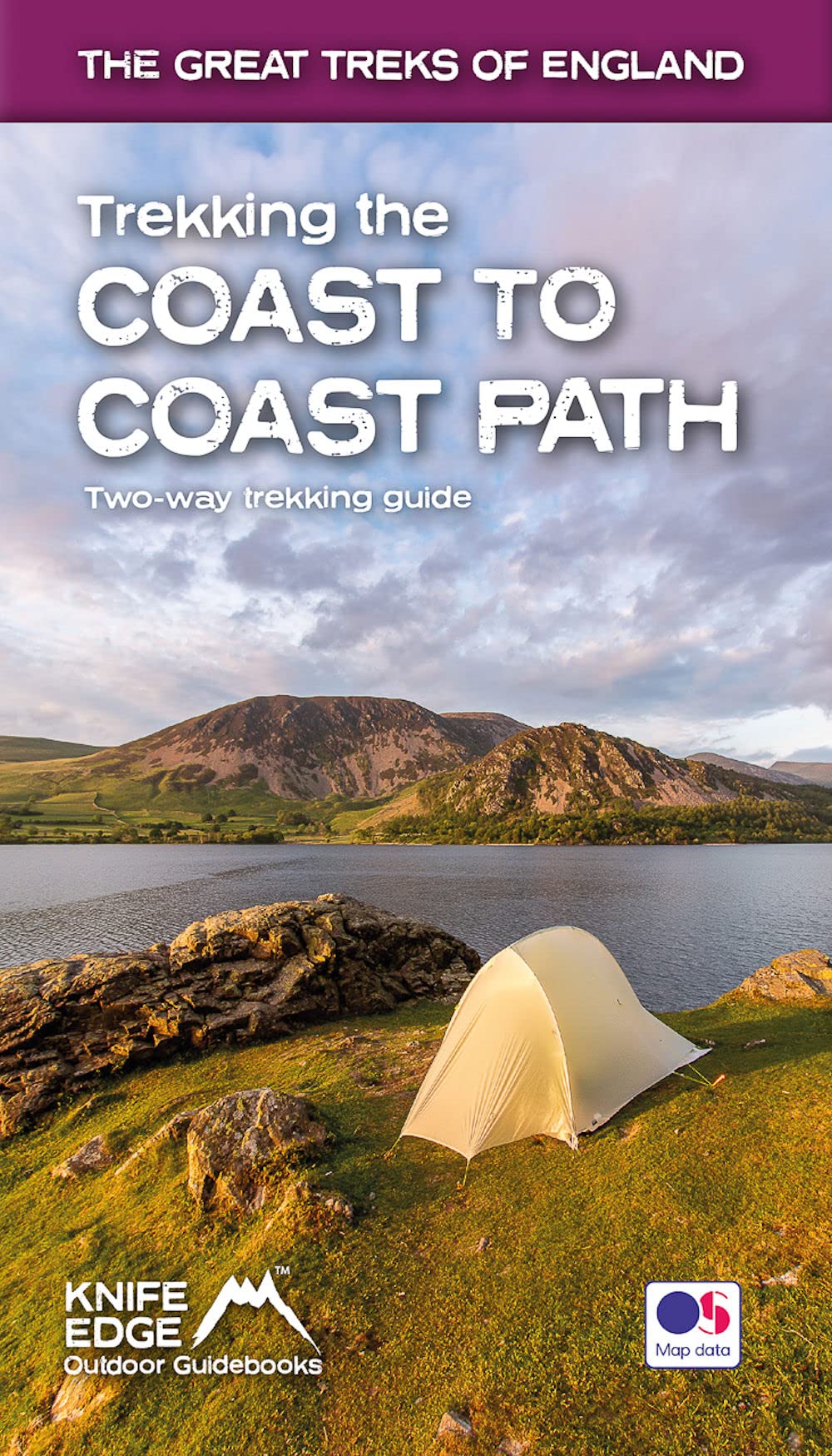
- Trekking the Coast to Coast Path
- Two-way trekking guide Read more
- Also available from:
- De Zwerver, Netherlands
De Zwerver
Netherlands
2022
Netherlands
2022
- Wandelgids Trekking the Coast to Coast Path | Knife Edge Outdoor
- Two-way trekking guide Read more

- Also available from:
- De Zwerver, Netherlands
- Stanfords, United Kingdom

De Zwerver
Netherlands
Netherlands

Stanfords
United Kingdom
United Kingdom
- Canterbury, East Kent, Dover & Margate OS Landranger Map 179 (paper)
- Eastern Kent with Canterbury, Dover and Margate, including sections of the North Downs Way and the E2 and E9 European Long-Distance Paths, on a paper version of map No. 179 from the Ordnance Survey’s Landranger series at 1:50,000, with contoured and GPS compatible topographic mapping plus tourist information.MOBILE DOWNLOADS: As well as the... Read more

- Also available from:
- De Zwerver, Netherlands
- Stanfords, United Kingdom

De Zwerver
Netherlands
2016
Netherlands
2016

Stanfords
United Kingdom
2016
United Kingdom
2016
- North York Moors Western OS Explorer Map OL26 (paper)
- The western part of the North York Moors National Park on a detailed topographic and GPS compatible map OL26, paper version, from the Ordnance Survey’s 1:25,000 Explorer series. Coverage extends from Ampleforth in the south northwards to Saltburn-by-the-Sea, and from Ingleby Arncliffe to Danby, Castleton and Hutton-le-Hole, and includes... Read more

- Also available from:
- Stanfords, United Kingdom

Stanfords
United Kingdom
United Kingdom
- Kettering, Corby, Market Harborough & Stamford OS Landranger Active Map 141 (waterproof)
- The area around Kettering, Corby, Market Harborough and Stamford, including Rockingham Forest and part of the E2 European Long-distance Path, on a waterproof and tear-resistant OS Active version of map No. 141 from the Ordnance Survey’s Landranger series at 1:50,000, with contoured and GPS compatible topographic mapping plus tourist... Read more
Karten

The Book Depository
United Kingdom
United Kingdom
- Cleveland Way
- Mooie, duidelijke kaart van de Cleveland Way in Noord-Engeland. Geplastificeerd met veel extra informatie en uitsnedes van de route. Leap forward in technical excellence. Tough, light and 100% waterproof Compact and light - the map itself weighs just 60gms - a third of the weight of a laminated map, and much less bulky. And you can fold or... Read more
- Also available from:
- De Zwerver, Netherlands
- Stanfords, United Kingdom
De Zwerver
Netherlands
Netherlands
- Wandelkaart Cleveland Way | Harvey Maps
- Mooie, duidelijke kaart van de Cleveland Way in Noord-Engeland. Geplastificeerd met veel extra informatie en uitsnedes van de route. Leap forward in technical excellence. Tough, light and 100% waterproof Compact and light - the map itself weighs just 60gms - a third of the weight of a laminated map, and much less bulky. And you can fold or... Read more

Stanfords
United Kingdom
United Kingdom
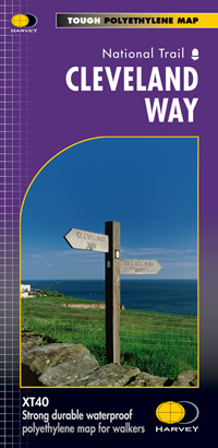
- Cleveland Way Harvey National Trail XT40
- Cleveland Way, established over 40 years ago as Britain’s second National Trail, presented at 1:40,000 on a GPS compatible, light, waterproof and tear-resistant map from Harvey Map Services. The 170km/109 miles route which starts in Helmsley, crosses the North York Moors National Park and sweeps southwards along the coast to Filey, is covered... Read more

The Book Depository
United Kingdom
United Kingdom
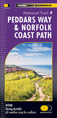
- Peddars Way & Norfolk Coast Path
- Detailed 1:40,000 scale maps of English and Welsh National trails and Scottish Great Trails”A great companion to a National Trail. Clear mapping and concise information enhance enjoyment of the journey.” Malcolm Hodgson, North York Moors NPA- The detail you need for sure navigation- Clear 1:40,000 scale mapping with full legend- Full legend-... Read more
- Also available from:
- De Zwerver, Netherlands
De Zwerver
Netherlands
Netherlands
- Wandelkaart Peddars Way & Norfolk Coast Path | Harvey Maps
- Detailed 1:40,000 scale maps of English and Welsh National trails and Scottish Great Trails”A great companion to a National Trail. Clear mapping and concise information enhance enjoyment of the journey.” Malcolm Hodgson, North York Moors NPA- The detail you need for sure navigation- Clear 1:40,000 scale mapping with full legend- Full legend-... Read more

The Book Depository
United Kingdom
United Kingdom
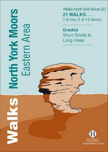
- North York Moors (Eastern)
- The eastern part of the North Yorkshire Moors at 1:25,000 in a series of Walker Read more
- Also available from:
- Stanfords, United Kingdom

Stanfords
United Kingdom
United Kingdom
- North York Moors East 25K AA/OS Walker`s Map No. 12
- The eastern part of the North Yorkshire Moors at 1:25,000 in a series of Walker’s Maps published by the AA with the cartography from the Ordnance Survey’s Explorer series. The map is double-sided and coverage includes the North Yorks Moors National Park, Scarborough, Robin Hood’s Bay, Whitby, Lythe, Staithes, Loftus, Goathland,... Read more

De Zwerver
Netherlands
2020
Netherlands
2020
- Fietskaart Yorkshire Dales Touring / Nidderdale Area of NB | Harvey Maps
- Yorkshire Dales on a road map at 1:100,000 from Harvey Map Services with several enlargements showing main roads across local towns, plus descriptions of interesting locations, advice on public transport, etc. The map shows the Dales region with altitude colouring to indicate the region Read more
- Also available from:
- Stanfords, United Kingdom

Stanfords
United Kingdom
2020
United Kingdom
2020
- Yorkshire Dales Harvey Touring & Planning Map
- Yorkshire Dales on a road map at 1:100,000 from Harvey Map Services with several enlargements showing main roads across local towns, plus descriptions of interesting locations, advice on public transport, etc. The map shows the Dales region with altitude colouring to indicate the region’s topography. Long-distance trails such as the Dales Way,... Read more
De Zwerver
Netherlands
2022
Netherlands
2022


De Zwerver
Netherlands
2021
Netherlands
2021

De Zwerver
Netherlands
2021
Netherlands
2021

Stanfords
United Kingdom
United Kingdom
- Malton and Pickering 1857-1925 (3-map set)
- Map No. 100, Malton and Pickering 1857-1925 (3-map set), in the Cassini Historical Series of old Ordnance Survey mapping of England and Wales at 1:50,000 in a format designed to offer a convenient comparison with the present day coverage from the OS, and most locations in three different editions. Old historical maps have been combined so that... Read more
Stanfords
United Kingdom
United Kingdom
- Malton and Pickering 1857-1861
- Map No. 100, Malton and Pickering 1857-1861, in the Cassini Historical Series of old Ordnance Survey mapping of England and Wales at 1:50,000 in a format designed to offer a convenient comparison with the present day coverage from the OS, and most locations in three different editions. Old historical maps have been combined so that the sheet... Read more

Stanfords
United Kingdom
United Kingdom
- North York Moors West AA Walker`s Map 19
- The western part of the North York Moors at 1:25,000 in a series of Walker’s Maps published by the AA with the cartography from the Ordnance Survey’s Explorer series. The map is double-sided and coverage includes North York Moors National Park, Middlesbrough, Salturn-by-the-Sea, Guisboroughm Stokesley, Castleton, Seave Green, Hutton-le-Hole,... Read more
Stanfords
United Kingdom
United Kingdom
- Whitby and Esk Dale 1857-1861
- Map No. 94, Whitby and Esk Dale 1857-1861, in the Cassini Historical Series of old Ordnance Survey mapping of England and Wales at 1:50,000 in a format designed to offer a convenient comparison with the present day coverage from the OS, and most locations in three different editions. Old historical maps have been combined so that the sheet... Read more

Stanfords
United Kingdom
United Kingdom
- North York Moors East A-Z Adventure Atlas
- The eastern part of the North Yorkshire Moors at 1:25,000 in a series of handy A5 size Adventure Atlases from Geographers` A-Z Map Company with cartography from the Ordnance Survey’s Explorer series. Coverage includes Whitby, Scarborough, Thornton-le-Dale, Pickering, Kirkbymoorside, Castleton and Loftus.To see other titles in this series please... Read more
Stanfords
United Kingdom
United Kingdom
- Malton & Pickering 1924-1925
- Map No. 100, Malton and Pickering 1924-1925, in the Cassini Historical Series of old Ordnance Survey mapping of England and Wales at 1:50,000 in a format designed to offer a convenient comparison with the present day coverage from the OS, and most locations in three different editions.Old historical maps have been combined so that the sheet... Read more