
Exmoor
Beschreibung
Exmoor National Park is located in southwest England, and is divided between the counties Somerset and Devon.
Exmoor is very different from the other main park in Devon: Dartmoor. Dartmoor is empty, infertile, very wet. Exmoor National Park on the other hand has a diverse nature, including farmlands, woods, small hamlets some of the wildest coastline in England, ánd moorland.
Wanderwege Region
Links
Fakten
Berichte
Führer und Karten
Übernachtung
Organisationen
Reisebüros
GPS
Sonstiges
Bücher

The Book Depository
United Kingdom
United Kingdom
- Walking Through the Past: Exmoor & Quantocks
- Walking on Exmoor and Walking on the Quantocks to Visit Sites with Significance to Archaeology and History Read more

- Also available from:
- De Zwerver, Netherlands

The Book Depository
United Kingdom
2013
United Kingdom
2013
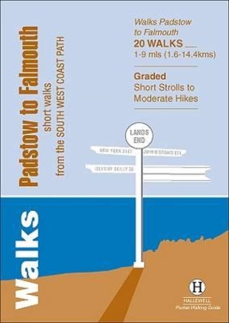
- Walks Padstow to Falmouth
- Short Walks from the South West Coast Path Read more
- Also available from:
- De Zwerver, Netherlands
De Zwerver
Netherlands
2013
Netherlands
2013
- Wandelgids Padstow to Falmouth | Hallewell Publications
- Short Walks from the South West Coast Path Read more

The Book Depository
United Kingdom
United Kingdom
- The Arrow Closest To The Acorn
- An American Woman's Walking Adventure On England's 630-Mile South West Coast Path Read more

- Also available from:
- De Zwerver, Netherlands
- Stanfords, United Kingdom
De Zwerver
Netherlands
Netherlands

Stanfords
United Kingdom
United Kingdom
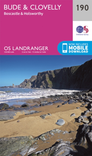
- Bude, Clovelly, Boscastle & Holsworthy OS Landranger Map 190 (paper)
- Bude and Clovelly area, including a section of the South West Coast Path, on a paper version of map No. 190 from the Ordnance Survey’s Landranger series at 1:50,000, with contoured and GPS compatible topographic mapping plus tourist information.MOBILE DOWNLOADS: As well as the physical edition of the map, each Landranger title now includes a... Read more

The Book Depository
United Kingdom
2022
United Kingdom
2022
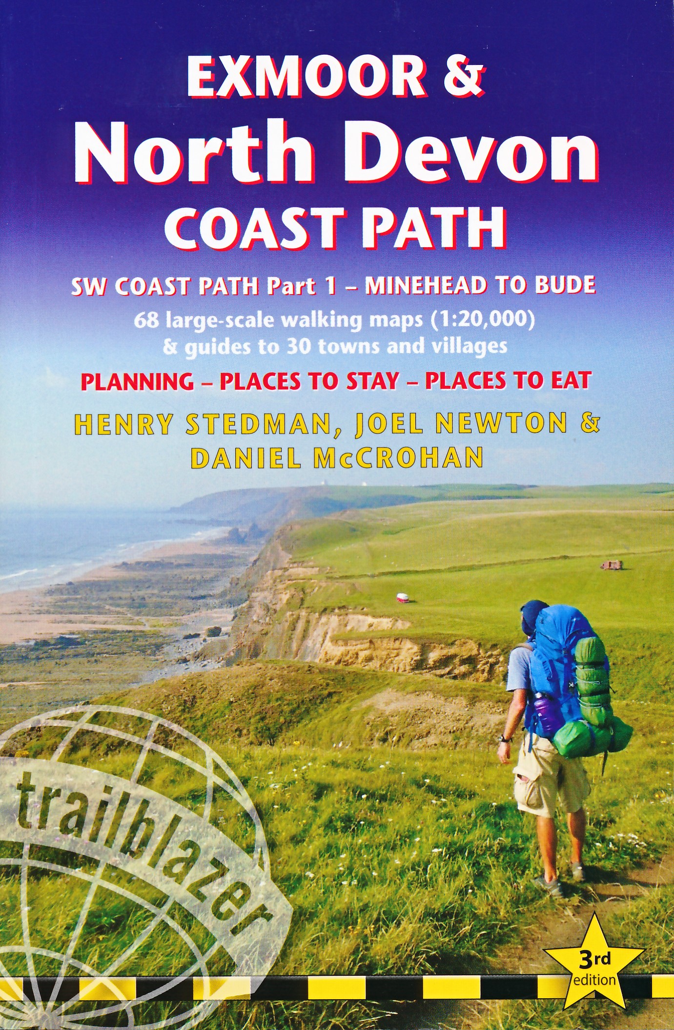
- Exmoor & North Devon Coast Path, South-West-Coast Path Part 1: Minehead to Bude (Trailblazer British Walking Guides)
- Practical walking guide with 55 large-scale walking maps (1:20,000) and guides to 30 towns and villages - planning, places to stay, places to eat Read more
- Also available from:
- De Zwerver, Netherlands
- Stanfords, United Kingdom
De Zwerver
Netherlands
2022
Netherlands
2022
- Wandelgids Exmoor and North Devon Coast Path | Trailblazer Guides
- Practical, complete guide to walking Exmoor & North Devon Coast Path, the first section of the South West Coast Path, from Minehead to Bude (124.5 miles). This spectacular route passes through the Exmoor National Park following the highest coastline in England (over 800ft), through numerous idyllic villages such as Lynton and Clovelly, around... Read more

Stanfords
United Kingdom
2022
United Kingdom
2022
- Exmoor & North Devon Coast Path, South-West-Coast Path Part 1: Minehead to Bude (Trailblazer British Walking Guide): Practical walking guide with 55 large-scale walking maps (1:20,000) and guides to 30 towns and villages - planning, places to stay, places
- Practical, complete guide to walking Exmoor & North Devon Coast Path, the first section of the South West Coast Path, from Minehead to Bude (124.5 miles). This spectacular route passes through the Exmoor National Park following the highest coastline in England (over 800ft), through numerous idyllic villages such as Lynton and Clovelly, around... Read more

- Also available from:
- Stanfords, United Kingdom

Stanfords
United Kingdom
United Kingdom
- Exeter, Sidmouth, Exmouth & Teignmouth OS Landranger Active Map 192 (waterproof)
- Exeter and Sidmouth area, including a section of the South West Coast Path / E9 European Long-distance Path, on a waterproof and tear-resistant OS Active version of map No. 192 from the Ordnance Survey’s Landranger series at 1:50,000, with contoured and GPS compatible topographic mapping plus tourist information.MOBILE DOWNLOADS: As well as the... Read more


- Also available from:
- De Zwerver, Netherlands
- Stanfords, United Kingdom
De Zwerver
Netherlands
2015
Netherlands
2015

Stanfords
United Kingdom
2015
United Kingdom
2015
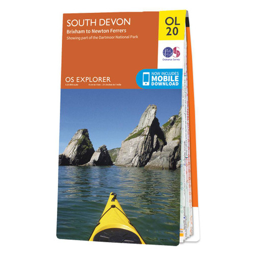
- South Devon - Brixham to Newton Ferrers OS Explorer Map OL20 (paper)
- The coast of South Devon on a detailed topographic and GPS compatible map OL20, paper version, from the Ordnance Survey’s 1:25,000 Explorer series. The map extends westwards beyond Newton Ferrers to Plymouth, eastwards beyond Brixham to Torquay, and inland to include part of the Dartmoor National Park. Coverage includes Paignton, Totness,... Read more

The Book Depository
United Kingdom
United Kingdom
- Coastal Pub Walks: Dorset
- Walks to amazing pubs along the South West Coast Path Read more
- Also available from:
- Stanfords, United Kingdom

Stanfords
United Kingdom
United Kingdom
- Coastal Pub Walks: Dorset: Walks to amazing pubs along the South West Coast Path
- One of seven books in the new Top 10 Walks: South West Coast Path series, these attractive and cleverly structured guides will give walkers ten of the best short circular walks along each of the five sections of the 630-mile long South West Coast Path in a popular pocket-size format.With clear information, an overview and introduction for each... Read more

The Book Depository
United Kingdom
2021
United Kingdom
2021
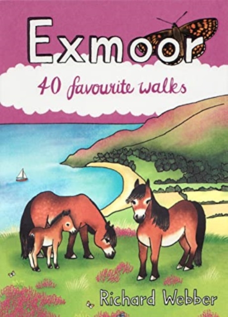
- Walks Exmoor
- Including Minehead to Ilfracombe: Short Walks from the South West Coast Path Read more
- Also available from:
- De Zwerver, Netherlands

De Zwerver
Netherlands
2021
Netherlands
2021
- Wandelgids Exmoor | Hallewell Publications
- Including Minehead to Ilfracombe: Short Walks from the South West Coast Path Read more

- Also available from:
- De Zwerver, Netherlands
- Stanfords, United Kingdom

De Zwerver
Netherlands
Netherlands

Stanfords
United Kingdom
United Kingdom
- Taunton, Lyme Regis, Chard & Bridport OS Landranger Map 193 (paper)
- Taunton and Lyme Regis area, including a section of the South West Coast Path / E9 European Long-distance Path, on a paper version of map No. 193 from the Ordnance Survey’s Landranger series at 1:50,000, with contoured and GPS compatible topographic mapping plus tourist information.MOBILE DOWNLOADS: As well as the physical edition of the map,... Read more

The Book Depository
United Kingdom
2022
United Kingdom
2022
- The South West Coast Path
- 1,000 Mini Adventures Along Britain's Longest Waymarked Path Read more
- Also available from:
- De Zwerver, Netherlands
- Stanfords, United Kingdom
De Zwerver
Netherlands
2022
Netherlands
2022
- Reisgids The South West Coast Path | Bloomsbury
- Often featuring in lists of the world`s best walks, the South West Coast Path is 630 miles long, and passes through two World Heritage Sites. This guide to the path is a modern take on the traditional (turn right at the stile, and follow the footpath to the bridge) guidebook: instead of telling readers where to go step by step, Stephen gives... Read more

Stanfords
United Kingdom
2022
United Kingdom
2022
- The South West Coast Path: 1,000 Mini Adventures Along Britain`s Longest Waymarked Path
- Often featuring in lists of the world`s best walks, the South West Coast Path is 630 miles long, and passes through two World Heritage Sites. This guide to the path is a modern take on the traditional (turn right at the stile, and follow the footpath to the bridge) guidebook: instead of telling readers where to go step by step, Stephen gives... Read more

- Also available from:
- Stanfords, United Kingdom

Stanfords
United Kingdom
United Kingdom
- Dorchester, Weymouth, Cerne Abbas & Bere Regis OS Landranger Active Map 194 (waterproof)
- Dorchester and Weymouth area, including a section of the South West Coast Path / E9 European Long-distance Path, on a waterproof and tear-resistant OS Active version of map No. 194 from the Ordnance Survey’s Landranger series at 1:50,000, with contoured and GPS compatible topographic mapping plus tourist information.MOBILE DOWNLOADS: As well as... Read more

- Also available from:
- De Zwerver, Netherlands
- Stanfords, United Kingdom
De Zwerver
Netherlands
Netherlands

Stanfords
United Kingdom
United Kingdom
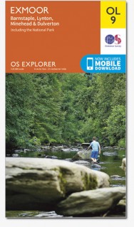
- Exmoor - Barnstaple, Lynton, Minehead & Dulverton OS Explorer Map OL9 (paper)
- The Exmoor National Park on a detailed topographic and GPS compatible map OL9, paper version, from the Ordnance Survey’s 1:25,000 Explorer series. Coverage extends westwards to Ilfracombe and Barnstaple and includes Minehead – the start of the South West Coast Path National Rrail, Lynton, Dulverton, sections of the Two Moors Way, Tarka Way,... Read more
Karten

- Also available from:
- Stanfords, United Kingdom

Stanfords
United Kingdom
United Kingdom
- Exmoor AA Walker`s Map 13
- Exmoor at 1:25,000 in a series of Walker’s Maps published by the AA with the cartography from the Ordnance Survey’s Explorer series. The map is double-sided and coverage includes the Exmoor National Park, Ilfracombe, Combe Martin, Lynton, Porlock, Minehead, Williton, Exford, Dulverton, Brayford, Barnstaple, etc.Maps in the AA Walker’s series... Read more

Stanfords
United Kingdom
United Kingdom
- Two Moors Way Harvey National Trail XT40
- Two Moors Way, a 150km / 93 mile long-distance trail between Lynmouth on the north coast of Devon and Ivybridge near Plymouth, crossing Exmoor and Dartmoor National Parks, presented at 1:40,000 on a light, waterproof and tear-resistant map from Harvey Map Services. The route is shown on six panels.Maps in the Harvey’s series covering Great... Read more
Stanfords
United Kingdom
United Kingdom
- Barnstaple and Ilfracombe 1809-1919 (3-map set)
- Map No. 180, Barnstaple and Ilfracombe 1809-1919 (3-map set), in the Cassini Historical Series of old Ordnance Survey mapping of England and Wales at 1:50,000 in a format designed to offer a convenient comparison with the present day coverage from the OS, and most locations in three different editions. Old historical maps have been combined so... Read more

Stanfords
United Kingdom
2015
United Kingdom
2015
- South West Coast Path 5 - Dorset A-Z Adventure Atlas
- South West Coast Path 5 - Dorset Adventure Atlas at 1:25,000 in a series of handy A5 size Adventure Atlases from Geographers` A-Z Map Company with cartography from the Ordnance Survey’s Explorer series. The guide covers the 138 km / 86 mile section of the SWCP National Trail between Lyme Regis and Poole and includes a route planner indicating... Read more

Stanfords
United Kingdom
United Kingdom
- Exmoor & Taunton Cycling Map 84
- Exmoor and Taunton area of Devon and Somerset at 1:100,000 on a handy size, 50x35cm, double-sided contoured map from Croydecycle, printed on waterproof and tear-resistant synthetic paper and showing National Cycle routes and numerous local facilities, including campsites, pubs, etc. Coverage extends from Combe Martin, Barnstaple and South... Read more

Stanfords
United Kingdom
United Kingdom
- Exmoor A-Z Adventure Atlas
- Exmoor at 1:25,000 in a series of handy A5 size Adventure Atlases from Geographers` A-Z Map Company with cartography from the Ordnance Survey’s Explorer series. Coverage includes the South West Coast path between Minehead and Combe Martin Bay, Two Moors Way, Tarka Train, Dulverton, Brendon Hills, etc.To see other titles in this series please... Read more

Stanfords
United Kingdom
United Kingdom
- Minehead and Brendon Hills 1809
- Map No. 181, Minehead and Brendon Hills 1809, in the Cassini Historical Series of old Ordnance Survey mapping of England and Wales at 1:50,000 in a format designed to offer a convenient comparison with the present day coverage from the OS, and most locations in three different editions. Old historical maps have been combined so that the sheet... Read more
Stanfords
United Kingdom
United Kingdom
- Barnstaple and Ilfracombe 1809
- Map No. 180, Barnstaple and Ilfracombe 1809, in the Cassini Historical Series of old Ordnance Survey mapping of England and Wales at 1:50,000 in a format designed to offer a convenient comparison with the present day coverage from the OS, and most locations in three different editions. Old historical maps have been combined so that the sheet... Read more
Stanfords
United Kingdom
United Kingdom
- Minehead and Brendon Hills 1919
- Map No. 181, Minehead and Brendon Hills 1919, in the Cassini Historical Series of old Ordnance Survey mapping of England and Wales at 1:50,000 in a format designed to offer a convenient comparison with the present day coverage from the OS, and most locations in three different editions. Old historical maps have been combined so that the sheet... Read more
Stanfords
United Kingdom
United Kingdom
- Barnstaple and Ilfracombe 1919
- Map No. 180, Barnstaple and Ilfracombe 1919, in the Cassini Historical Series of old Ordnance Survey mapping of England and Wales at 1:50,000 in a format designed to offer a convenient comparison with the present day coverage from the OS, and most locations in three different editions. Old historical maps have been combined so that the sheet... Read more
Stanfords
United Kingdom
United Kingdom
- Minehead and Brendon Hills 1898-1900
- Map No. 181, Minehead and Brendon Hills 1898-1900, in the Cassini Historical Series of old Ordnance Survey mapping of England and Wales at 1:50,000 in a format designed to offer a convenient comparison with the present day coverage from the OS, and most locations in three different editions. Old historical maps have been combined so that the... Read more
Stanfords
United Kingdom
United Kingdom
- Barnstaple and Ilfracombe 1900
- Map No. 180, Barnstaple and Ilfracombe 1900, in the Cassini Historical Series of old Ordnance Survey mapping of England and Wales at 1:50,000 in a format designed to offer a convenient comparison with the present day coverage from the OS, and most locations in three different editions. Old historical maps have been combined so that the sheet... Read more