
Santiago de Compostela Pilgrims Way
Beschreibung
- Name Santiago de Compostela Pilgrims Way
- Ende von Wanderweg Santiago de Compostela
- Traildino Schwierigkeit MW, Mittelschwere Wanderung mit Rucksack
- Schwierigkeitsgrad Berg- und Alpinwanderung T1, Wandern


Ever since the year 813, when the tomb of St.James was claimed to be (re-)discovered there, the city of Santiago de Compostela in northwestern Spain has attracted many thousands of Christian pilgrims from all parts of Europe, particularly in the Middle Ages. As a result, there is no single route or trail. Of course, it all depends on where you start your pilgrimage.
Almost every West European country has an association, society or confraternity dedicated to pilgrimage to Santiago de Compostela, often carrying the name of the apostle involved: St.James, known by numerous translations such as Sint Jacob, Sint Jakobus, Saint-Jacques, Sankt Jakob, Sant Iago, etc. These organisations all provide information on the pilgrimage to their members, and also issue an official internationally recognized ‘pilgrim pass'. Having collected the correct stamps en route, pass-holders are entitled to the official ‘Compostela' certificate to prove that the pilgrimage was accomplished as intended.
Visit Traildino's overview page for the Way of Saint James / Camino de Santiago.
Karte


Links
Fakten
Berichte
Führer und Karten
Übernachtung
Organisationen
Reisebüros
GPS
Sonstiges
Bücher

United Kingdom
- The Road to Find Out
- A Modern Pilgrim and the Camino de Santiago Read more

United Kingdom
2023
- A Pilgrim's Guide to the Camino De Santiago
- Camino Frances St. Jean Pied De Port - Santiago Read more

United Kingdom
- Come fare il primo cammino di Santiago
- Tutto quello che devi sapere per prepararti al Camino De La Vida Read more


United Kingdom
2022
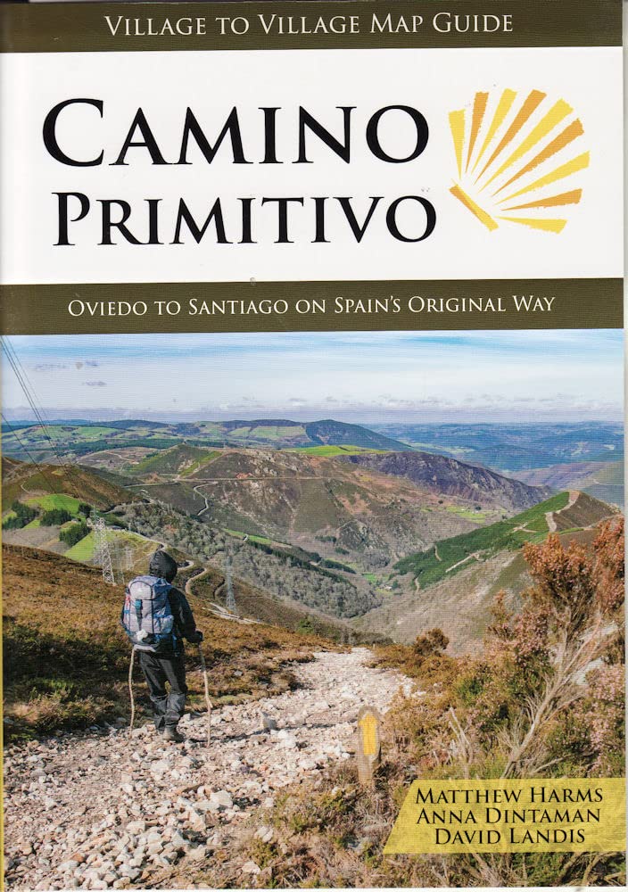
- Camino Primitivo
- Oviedo to Santiago on Spain's Original Way Read more
- Also available from:
- De Zwerver, Netherlands
Netherlands
2022
- Wandelgids Camino Primitivo | Village to Village Press
- Oviedo to Santiago on Spain's Original Way Read more


United Kingdom
- Turning 50 on El Camino de Santiago
- A Solo Woman's Travel Adventure Read more


United Kingdom
- Senior Camino
- A Guide for Seniors Walking the Camino de Santiago Read more

United Kingdom
- (How to do) The First Walk of Santiago de Compostela
- All you need to know before during and after your walking Read more

United Kingdom
2019
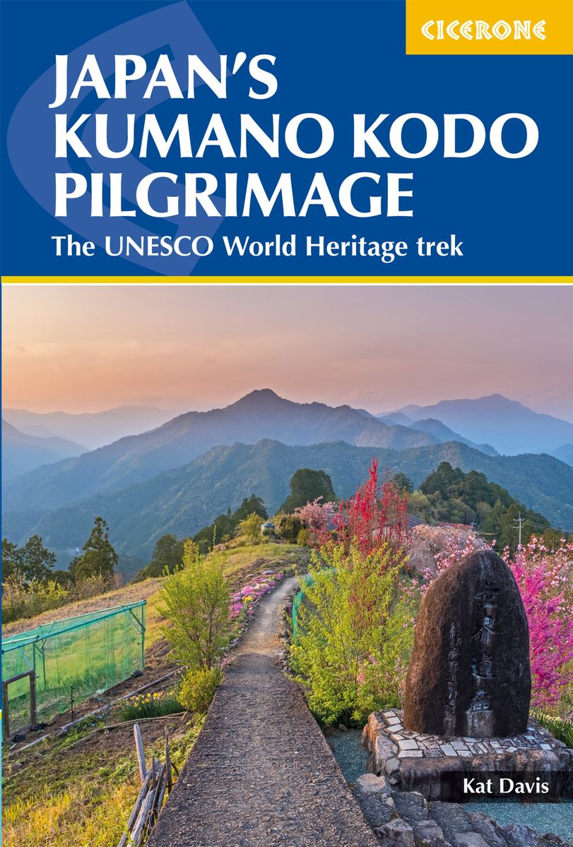
- Japan's Kumano Kodo Pilgrimage
- The UNESCO World Heritage trek Read more
- Also available from:
- De Zwerver, Netherlands
Netherlands
2019
- Wandelgids Japan's Kumano Kodo Pilgrimage | Cicerone
- Guidebook to walking Japan's Kumano Kodo, a network of ancient pilgrimage trails on the Kii Peninsula, south of Osaka. Covering the Nakahechi, Kohechi and Iseji trails, as well as Koyasan and the Choishimichi route, the guide has all the practical information needed, along with notes on the routes' rich history and culture. Read more

United Kingdom
- Moon Camino de Santiago (Second Edition)
- Sacred Sites, Historic Villages, Local Food & Wine Read more
Karten

Netherlands
2020
- Wandelatlas - Pelgrimsroute (kaart) 161 Chemins de Compostelle GR65 | Michelin
- Véritable petit atlas détaillant chaque étape avec indications précises concernant les villes de départ et d'arrivée ainsi que pour les localités traversées (auberges, refuges, restaurants, pharmacies, gare, épiceries, Km parcourus, Km restants....).Ce petit atlas suit le chemin du... Read more

Netherlands
- Wandelkaart - Pelgrimsroute (kaart) 133 Spanischer Jakobsweg | Kompass
- The main route of the Way of St James to Compostela across northern Spain presented at 1:100,000 on a durable, waterproof and tear-resistant map from Kompass, arranged as 26 separate strips, each with a route profile, plus additional street plans of central Logro Read more
- Also available from:
- Stanfords, United Kingdom

United Kingdom
- The Way of St. James to Compostela: Spanish Section
- The main route of the Way of St James to Compostela across northern Spain presented at 1:100,000 on a durable, waterproof and tear-resistant map from Kompass, arranged as 26 separate strips, each with a route profile, plus additional street plans of central Logroño, Burgos, León and Santiago itself.The whole route is covered on 26 panels, each... Read more

Netherlands
2020
- Wandelatlas - Pelgrimsroute (kaart) 160 Camino de Santiago | Michelin
- Parcourez le Chemin Français (Camino Francés) avec ce petit atlas de poche Michelin. L'outil idéal pour mieux s'y retrouver lors de la préparation du voyage de randonnée sur ce sentier historique qui part de Saint-Jean-Pied-de-Port, dans le Pays basque français, et qui traverse tout le nord de l'Espagne... Read more

Netherlands
- Pelgrimsroute (kaart) - Wandelkaart Camino de Santiago in Spanje | CNIG - Instituto Geográfico Nacional
- All roads leading to Santiago de Compostela in the Iberian Peninsula are represented on this Caminos de Santiago / The Way of St. James Map. Routes highlighted on a physical map of the Iberian Peninsula at 1:1,250,000 from IGN/CNIG, Spain civilian topographic survey organization. The base map with altitude colouring and relief shading provides... Read more
- Also available from:
- Stanfords, United Kingdom

United Kingdom
- Caminos de Santiago / Ways of St. James on the Iberian Peninsula CNIG Overview Map
- All roads leading to Santiago de Compostela in the Iberian Peninsula are represented on this Caminos de Santiago / The Way of St. James Map. Routes highlighted on a physical map of the Iberian Peninsula at 1:1,250,000 from IGN/CNIG, Spain civilian topographic survey organization. The base map with altitude colouring and relief shading provides... Read more

Netherlands
2021
- Also available from:
- Stanfords, United Kingdom

United Kingdom
2021
- France - Ways of St James IGN Map 922
- France: Ways of St James to Compostela Map from the IGN presents an overview of all the routes across France taken by pilgrims on their way to Santiago de Compostela and the tomb of the apostle St James - the greatest of all goals for thousands of pilgrims in Europe during the Middle Ages. The map was prepared by the IGN and the Association de... Read more
Netherlands
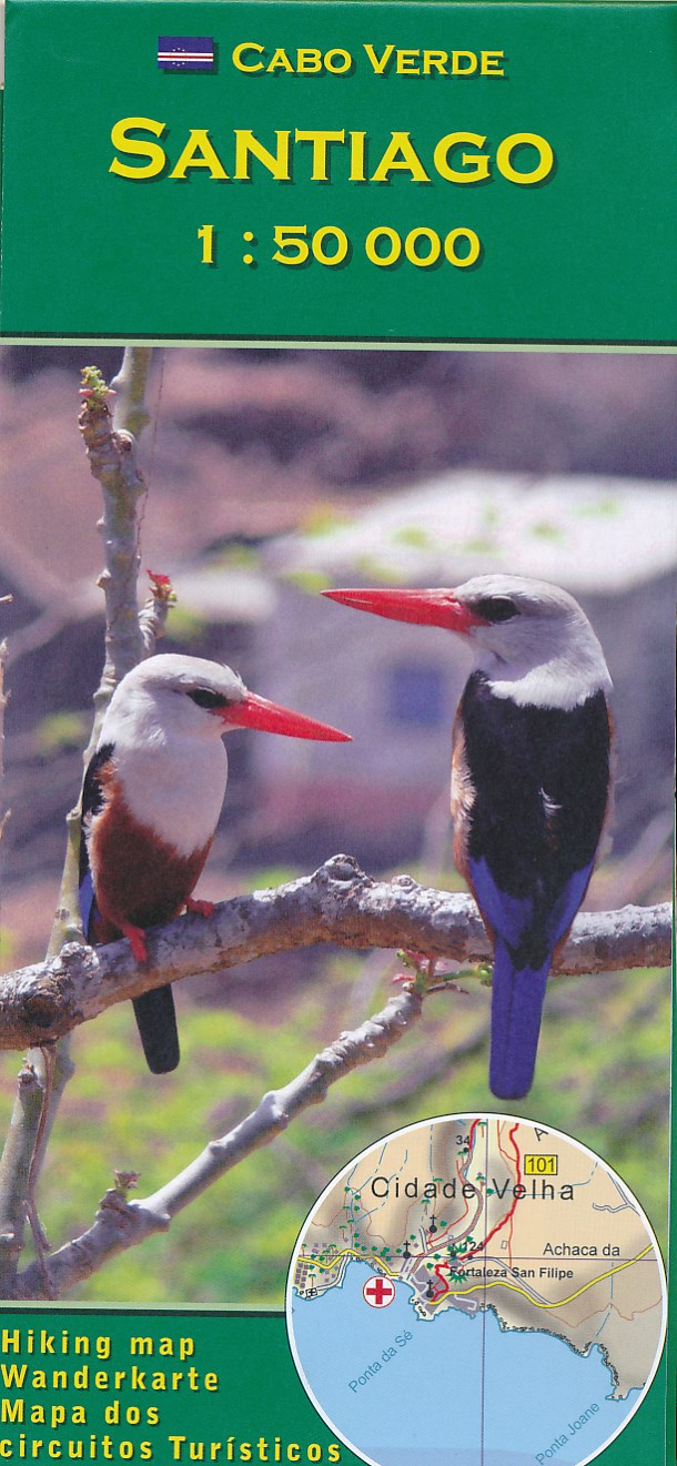
- Wandelkaart Santiago - Kaapverdische Eilanden | AB Kartenverlag
- Santiago Island in the Cape Verde archipelago on a detailed, GPS compatible map at 1:50,000 from AB Kartenverlag, highlighting 33 hiking and mountain bike routes and including small plans of Praia, Tarrafal and Cidade Velha. The map is double-sided with a very generous overlap between the sides. Contours with relief shading and spot heights... Read more
- Also available from:
- Stanfords, United Kingdom

United Kingdom
- Santiago AB Kartenverlag Hiking Map
- Santiago Island in the Cape Verde archipelago on a detailed, GPS compatible map at 1:50,000 from AB Kartenverlag, highlighting 33 hiking and mountain bike routes and including small plans of Praia, Tarrafal and Cidade Velha. The map is double-sided with a very generous overlap between the sides. Contours with relief shading and spot heights... Read more
Netherlands
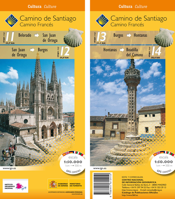
- Wandelkaart 11-14 Camino Santiago de Compostella Belorado - Boadilla | CNIG - Instituto Geográfico Nacional
- Camino de Santiago: Stages 11/12/13/14, Belorado/Boadilla del Camino, in a series of double-sided topographic maps at 1:50,000 from the Spanish civilian survey organization, overprinted with the route and sights, plus information of accommodation and other facilities, route profiles, etc.Each 1:50,000 map is double-sided and has four 57 x 35cm... Read more
- Also available from:
- Stanfords, United Kingdom

United Kingdom
- Camino de Santiago: Stages 11/12/13/14, Belorado/Boadilla del Camino 50K CNIG Map
- Camino de Santiago: Stages 11/12/13/14, Belorado/Boadilla del Camino, in a series of double-sided topographic maps at 1:50,000 from the Spanish civilian survey organization, overprinted with the route and sights, plus information of accommodation and other facilities, route profiles, etc.Each 1:50,000 map is double-sided and has four 57 x 35cm... Read more
Netherlands
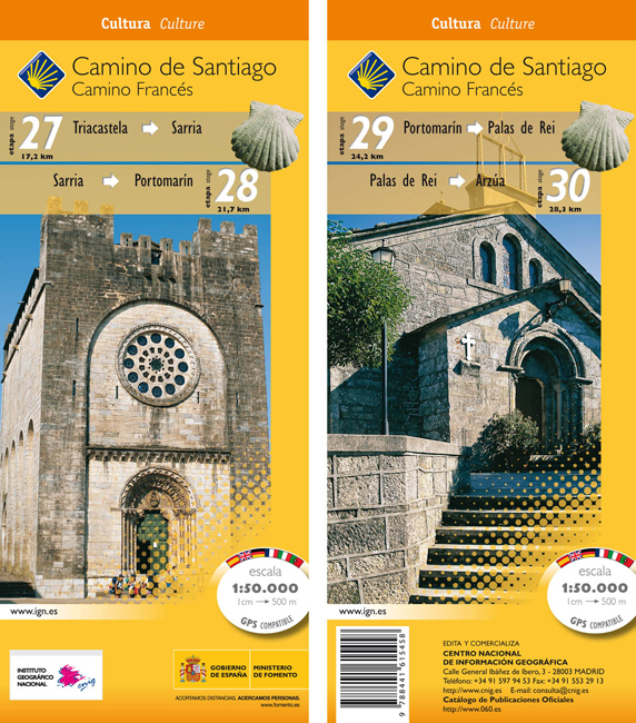
- Wandelkaart 27-30 Camino Santiago de Compostella Triacastela - Arzúa | CNIG - Instituto Geográfico Nacional
- Camino de Santiago: Camino de Santiago: Stages 27/28/29/30, Triacastela/Arzúa, in a series of double-sided topographic maps at 1:50,000 from the Spanish civilian survey organization, overprinted with the route and sights, plus information of accommodation and other facilities, route profiles, etc.Each 1:50,000 map is double-sided and has four... Read more
- Also available from:
- Stanfords, United Kingdom
United Kingdom
- Camino de Santiago: Stages 27/28/29/30, Triacastela/Arzúa 50K CNIG Map
- Camino de Santiago: Camino de Santiago: Stages 27/28/29/30, Triacastela/Arzúa, in a series of double-sided topographic maps at 1:50,000 from the Spanish civilian survey organization, overprinted with the route and sights, plus information of accommodation and other facilities, route profiles, etc.Each 1:50,000 map is double-sided and has four... Read more
Netherlands
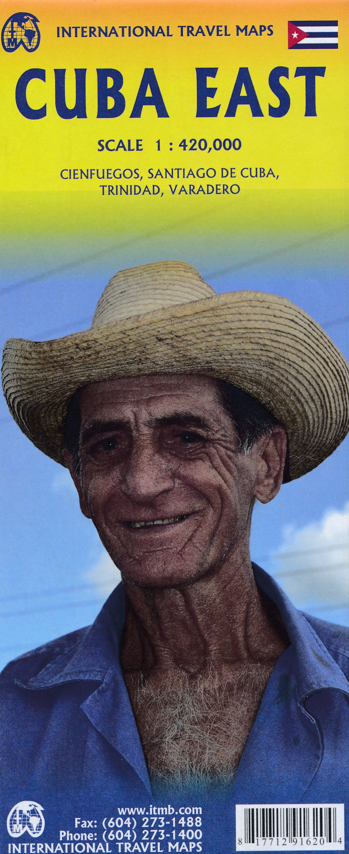
- Wegenkaart - landkaart Cuba east | ITMB
- Cuba East 1:42 0000 ab 10.49 EURO Landkarte, doppelseitig Pläne Varadero, Cienfuegos, Trinidad, Santiago International Travel Map ITM. 1. Auflage Read more
Netherlands
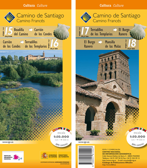
- Wandelkaart 15-18 Camino Santiago de Compostella Boadilla - Mansilla | CNIG - Instituto Geográfico Nacional
- Camino de Santiago: Stages 15/16/17/18, Boadilla del Camino/Mansilla de las Mulas, in a series of double-sided topographic maps at 1:50,000 from the Spanish civilian survey organization, overprinted with the route and sights, plus information of accommodation and other facilities, route profiles, etc.Each 1:50,000 map is double-sided and has... Read more
- Also available from:
- Stanfords, United Kingdom
United Kingdom
- Camino de Santiago: Stages 15/16/17/18, Boadilla del Camino/Mansilla de las Mulas 50K CNIG Map
- Camino de Santiago: Stages 15/16/17/18, Boadilla del Camino/Mansilla de las Mulas, in a series of double-sided topographic maps at 1:50,000 from the Spanish civilian survey organization, overprinted with the route and sights, plus information of accommodation and other facilities, route profiles, etc.Each 1:50,000 map is double-sided and has... Read more
Netherlands
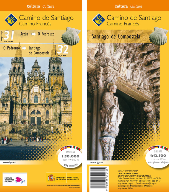
- Wandelkaart 31-32 Camino Santiago de Compostella Arzúa - Santiago | CNIG - Instituto Geográfico Nacional
- The Way of St James: the two last stages, 31 and 32, from Arzúa to Santiago de Compostela, plus a street plan of Santiago de Compostela in a series of double-sided topographic maps at 1:50,000 from the Spanish civilian survey organization, overprinted with the route and sights, plus information of accommodation and other facilities, route... Read more
- Also available from:
- Stanfords, United Kingdom
United Kingdom
- Camino de Santiago: Stages 31/32, Arzúa/Santiago de Compostela 50K CNIG Map
- The Way of St James: the two last stages, 31 and 32, from Arzúa to Santiago de Compostela, plus a street plan of Santiago de Compostela in a series of double-sided topographic maps at 1:50,000 from the Spanish civilian survey organization, overprinted with the route and sights, plus information of accommodation and other facilities, route... Read more

Netherlands
- Wegenkaart - landkaart Cuba | ITMB
- Cuba ( Kuba) 1 : 600 000 ab 10.49 EURO La Habana, Varadero, Santiago de Cuba International Travel Map ITM. new edition Read more
Netherlands
- Wegenkaart - landkaart Spanje Noord - Camino de Santiago | Freytag & Berndt
- Spanien - Jakobsweg, Autokarte 1:400.000 ab 10.9 EURO Touristische Informationen, Pilgerpass, Citypläne, Ortsregister mit GPS Freytag & Berndt Autokarte Read more
Netherlands
- Wandelkaart 19-22 Camino Santiago de Compostella Mansilla - Rabanal | CNIG - Instituto Geográfico Nacional
- Camino de Santiago: Stages 19/20/21/22, Mansilla de las Mulas/Rabanal del Camino, in a series of double-sided topographic maps at 1:50,000 from the Spanish civilian survey organization, overprinted with the route and sights, plus information of accommodation and other facilities, route profiles, etc.Each 1:50,000 map is double-sided and has... Read more
- Also available from:
- Stanfords, United Kingdom

United Kingdom
- Camino de Santiago: Stages 19/20/21/22, Mansilla de las Mulas/Rabanal del Camino 50K CNIG Map
- Camino de Santiago: Stages 19/20/21/22, Mansilla de las Mulas/Rabanal del Camino, in a series of double-sided topographic maps at 1:50,000 from the Spanish civilian survey organization, overprinted with the route and sights, plus information of accommodation and other facilities, route profiles, etc.Each 1:50,000 map is double-sided and has... Read more

Netherlands
- Wegenkaart - landkaart Camino de Santiago - Camino Frances | CNIG - Instituto Geográfico Nacional
- Northern Spain on an overview map at 1:500,000 highlighting the course of the Camino Francés route of the Way of St James from the Pyrenees to Santiago de Compostela via Burgos and León. Published by Spain’s civilian survey organization as part of their set providing topographic coverage of the route at 1:50,000, the map is also available... Read more
- Also available from:
- Stanfords, United Kingdom

United Kingdom
- Way of St James / Camino de Santiago CNIG Overview Map
- Northern Spain on an overview map at 1:500,000 highlighting the course of the Camino Francés route of the Way of St James from the Pyrenees to Santiago de Compostela via Burgos and León. Published by Spain’s civilian survey organization as part of their set providing topographic coverage of the route at 1:50,000, the map is also available... Read more