
Österreich
Beschreibung
 Thinking of Austria evokes images of the Alps and trekking from hut to hut. Many mountain groups have their own "Höhenweg", high altitude hut to hut trail.
Less well known are the 10 Austrian long distance hiking trails. These trails cross all the country's majestic mountain ranges - Ötztal, Zillertal, Stubaier Alps, Hohe Tauern - but also pass through more pastoral and less touristic regions of Austria. Sometimes the trails coincide with European long distance trails.
Don't be mistaken: Austrian long distance trails are not for the feeble. Time and again the trails mean serious business, including glaciers and short stretches of scrambling on rocks (maximum Grade II). To complete a trail on foot can easily take several months. Varying in length from 400 to 1300 km, and combined with the considerable differences in altitude, these trails pose challenges to be reckoned with. So, compared to the French GR's, the Austrian long distance trails are on another level altogether. Make sure you master all skills of walking in high mountains: techniques of orientation, gear, surefootedness, stamina.
To keep hikers happy, after all we are hiking for fun, Austria has taken excellent care of lodging, food and drink. Wherever you go up into the mountains, you will find well managed huts, offering a comfortable bed, beer, and top meals you will never find down the valleys: all purely natural and 100% homemade. More than merely an overnight stay, this is enjoying!
Karte


Wanderwege
- AdlerwegGPX
- AlpannoniaGPX
- Alpen Weitwanderweg
- ArnowegGPX
- Berliner HöhenwegGPX
- Bodensee RundwegGPX
- Burgen und SchlösserwegGPX
- Burgenländische Pilgerwege
- Christophorus Rundwanderweg
- Dachstein-Tauern Panoramaweg
- DonausteigGPX
- E10GPX
- E4GPX
- E5GPX
- E6GPX
- E8GPX
- Eisenwurzenweg - 8GPX
- Gailtaler HöhenwegGPX
- GoethewegGPX
- KalkalpenwegGPX
- Karnischer HöhenwegGPX
- Karwendel Höhenweg
- Kreuzecker Höhenweg
- Lasörling HöhenwegGPX
- Lechtaler HöhenwegGPX
- LechwegGPX
- Mariazeller Wege - 6GPX
- MaximilianswegGPX
- Meraner HöhenwegGPX
- Nord-Süd Wanderweg - 5GPX
- Nordalpenweg - 1GPX
- NordwaldkammwegGPX
- Ostösterreichischer Grenzlandweg - 7GPX
- Rätikon Höhenweg
- Rupertiweg - 10GPX
- Salzburger AlmenwegGPX
- Salzsteigweg - 9GPX
- Santiago de Compostela Pilgrims WayGPX
- Südalpenweg - 3GPX
- Schladminger Tauern Höhenweg
- Sentiero della PaceGPX
- Stubaier HöhenwegGPX
- Sultan's TrailGPX
- Tauernhöhenweg
- Templar Trail
- Tiroler Höhenweg
- Traumpfad München-VenedigGPX
- Venediger HöhenwegGPX
- Verwall Höhenweg
- Via AlpinaGPX
- Via ValtellinaGPX
- Voralpenweg - 4GPX
- Weg des BuchesGPX
- Zentralalpenweg - 2GPX
Regionen
- Allgäuer Alpen
- Alps
- Ammergauer Alpen
- Ankogelgruppe
- Ötztal
- Bayerische Voralpen
- Berchtesgadener Alpen
- Bodensee
- Bregenzerwald
- Chiemgauer Alpen
- Dachstein
- Defereggengebirge
- Eisenerzer Alpen
- Eisenwurzen
- Ennstaler Alpen
- Fischbacher Alpen
- Gailtaler Alpen
- Gesäuse
- Gleinalpe
- Glocknergruppe
- Goldberggruppe
- Granatspitzgruppe
- Gurktaler Alpen
- Gutensteiner Alpen
- Hochkönig
- Hochschwab
- Hohe Tauern
- Isarwinkel
- Julische Alpen
- Kaisergebirge
- Kamnik Savinja Alpen
- Karawanken
- Karnischer Alpen
- Karwendel
- Kaunertal
- Kitzbüheler Alpen
- Koralpe
- Kreuzeckgruppe
- Lechquellengebirge
- Lechtaler Alpen
- Leoganger Steinberge
- Lienzer Dolomiten
- Loferer Steinberge
- Mühlviertel
- Mürzsteger Alpen
- Mieminger Kette
- Neusiedler See
- Niedere Tauern
- Nockberge
- Pohorje
- Radstädter Tauern
- Rax-Schneeberg-Gruppe
- Rätikon
- Rieserfernergruppe
- Rofan
- Rottenmänner Tauern
- Salzburger Schieferalpen
- Salzkammergut-Berge
- Samnaun
- Saualpe
- Schladminger Tauern
- Schobergruppe
- Seckauer Tauern
- Seetaler Alpen
- Sengsengebirge
- Silvretta
- Steinernes Meer
- Stubai
- Tannheimer Bergen
- Türnitzer Alpen
- Tennengebirge
- Texelgruppe
- Tirol
- Totes Gebirge
- Tuxer Alpen
- Venedigergruppe
- Verwall
- Waldviertel
- Wölzer Tauern
- Weinviertel
- Wetterstein
- Wiener Hausberge
- Wienerwald
- Ybbstaler Alpen
- Zillertal
Landesteile
Berge
- Ankogel
- Augstenberg
- Östliche Seespitze
- Äussere Schwarze Schneid
- Berliner Spitze
- Birkkarspitze
- Birnhorn
- Bliggspitze
- Breiter Grießkogel
- Daberspitze
- Daniel
- Dreiherrenspitze
- Dreiländerspitze
- Eisenhut
- Eiskastenspitze
- Ellmauer Halt
- Feuerstein
- Fineilspitze
- Firmisanschneide
- Fluchthorn
- Fluchtkogel
- Fuscherkarkopf
- Gaislehnkogel
- Gamsfeld
- Gefrorene-Wand-Spitzen
- Geierhaupt
- Glatthorn
- Glödis
- Glocknerwand
- Glockturm
- Granatenkogel
- Große Sandspitze
- Große Wildgrubenspitze
- Großer Bärenkopf
- Großer Geiger
- Großer Greiner
- Großer Hexenkopf
- Großer Hornkopf
- Großer Krottenkopf
- Großer Löffler
- Großer Mörchner
- Großer Möseler
- Großer Muntanitz
- Großer Priel
- Großer Ramolkogel
- Großer Sulzberg
- Großes Ochsenhorn
- Großes Wiesbachhorn
- Großglockner
- Großvenediger
- Gsallkopf
- Habicht
- Hintere Ölgrubenspitze
- Hintere Schwärze
- Hintere Spiegelkogel
- Hintere Stangenspitze
- Hintereisspitzen
- Hinterer Brochkogel
- Hinterer Brunnenkogel
- Hinterer Daunkopf
- Hinterer Seelenkogel
- Hochalmspitze
- Hocharn
- Hocheiser
- Hochfeiler
- Hochfirst
- Hochgall
- Hochgolling
- Hochiss
- Hochkönig
- Hochschober
- Hochschwab
- Hochstadl
- Hochtor
- Hochvernagtspitze
- Hochwilde
- Hohe Fürlegg
- Hohe Geige
- Hohe Veitsch
- Hohe Wand
- Hohe Warte
- Hoher Dachstein
- Hoher Eichham
- Hoher Nock
- Hoher Riffler
- Hoher Riffler (Verwall)
- Hoher Seeblaskogel
- Hoher Tenn
- Im Hinteren Eis
- Innere Schwarze Schneid
- Johannisberg
- Karlesspitze
- Keeskogel
- Kitzsteinhorn
- Klockerin
- Kreuzjoch
- Kreuzspitze
- Langtauferer Spitze
- Längentaler Weißer Kogel
- Löcherkogel
- Lüsener Fernerkogel
- Lenkstein
- Liebenerspitze
- Lizumer Reckner
- Malhamspitzen
- Mölltaler Polinik
- Mittlerer Bärenkopf
- Mutmalspitze
- Olperer
- Parseierspitze
- Petzeck
- Piz Buin
- Piz Buin Pitschen
- Puitkogel
- Quirl
- Rainerhorn
- Raucheck
- Rauhkofel
- Rötspitze
- Reichenspitze
- Reisalpe
- Rettlkirchspitze
- Rofelewand
- Rostizkogel
- Roter Knopf
- Ruderhofspitze
- Schalfkogel
- Schaufelspitze
- Schöpfl
- Schesaplana
- Schlieferspitze
- Schneeberg
- Schrammacher
- Schrandele
- Schrankogel
- Schwabenkopf
- Schwarzenbergspitzen
- Schwarzenstein
- Seekogel
- Sennkogel
- Signalhorn
- Silvrettahorn
- Similaun
- Sonklarspitze
- Sonntagshorn
- Stol
- Strahlkogel
- Stubaier Wildspitze
- Stuhleck
- Talleitspitze
- Turnerkamp
- Verpeilspitze
- Vordere Ölgrubenspitze
- Vordere Diemkogel
- Vorderer Brochkogel
- Vorderer Brunnenkogel
- Warenkarseitenspitze
- Wassertalkogel
- Watzespitze
- Weiße Spitze
- Weißeck
- Weißer Kogel
- Weißkugel
- Weißseespitze
- Weißspitze
- Westlicher Simonyspitze
- Wilde Leck
- Wilder Freiger
- Wilder Pfaff
- Wildgerlosspitze
- Wildspitze
- Windacher Daunkogel
- Wollbachspitze
- Zirbitzkogel
- Zirmkogel
- Zopetspitze
- Zuckerhütl


Links
Fakten
Berichte
Führer und Karten
Übernachtung
Organisationen
Reisebüros
GPS
Sonstiges
Bücher

United Kingdom
2018
- Innsbruck Mountain Adventures
- Summer routes for a multi-activity holiday around the capital of Austria's Tirol Read more
- Also available from:
- De Zwerver, Netherlands

Netherlands
2018
- Klimgids - Klettersteiggids Innsbruck Mountain Adventures | Cicerone
- Summer routes for a multi-activity holiday around the capital of Austria's Tirol Read more

United Kingdom
2022
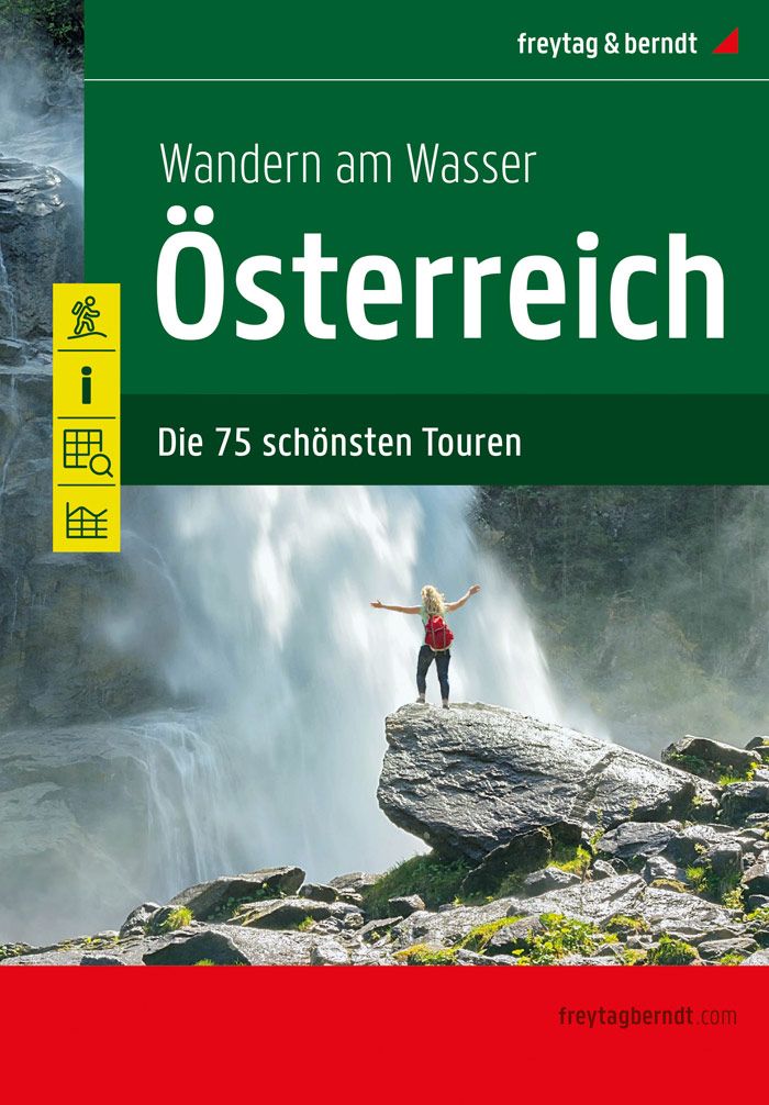
- Hiking by the Water Hiking Guidebook
- 75 best routes in Austria Read more
- Also available from:
- De Zwerver, Netherlands
Netherlands
2022
- Wandelgids Wandern am Wasser Österreich | Freytag & Berndt
- 75 best routes in Austria Read more
Netherlands
2017
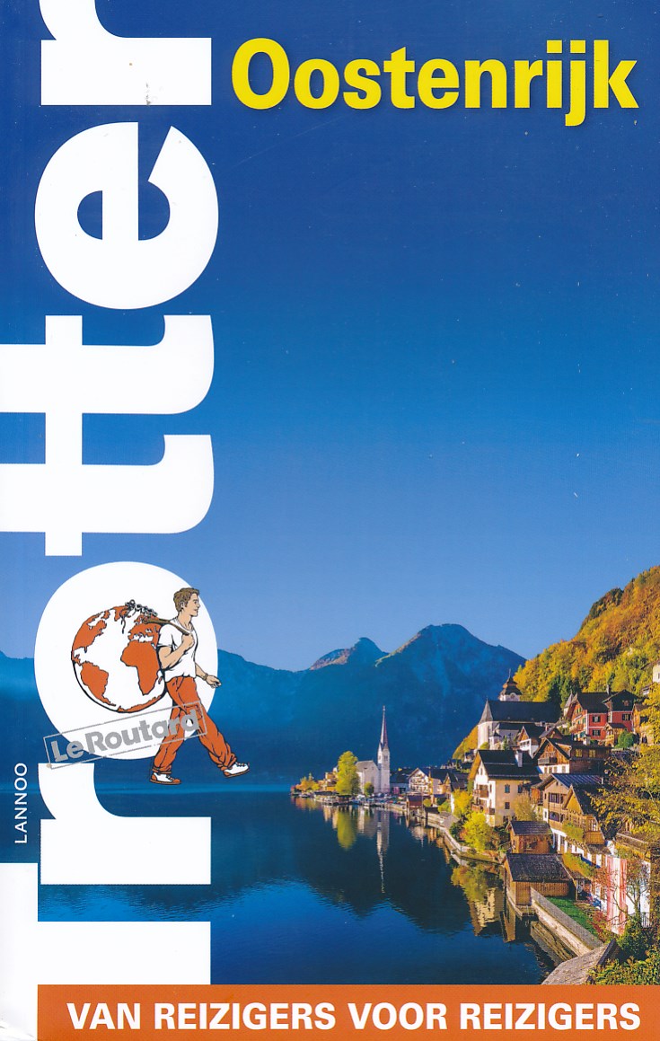
- Reisgids Trotter Oostenrijk | Lannoo
- Goede informatieve gids met nadruk op praktische informatie om rond te reizen. Echter ook aandacht voor cultuur en geschiedenis. Geschreven met prachtige Belgische humor, oorspronkelijk Franse gids. De onmisbare gids voor echte trotters Eigenzinnige en kritische benadering van klassieke trekpleisters en verborgen parels buiten de platgetreden... Read more
Netherlands
2018
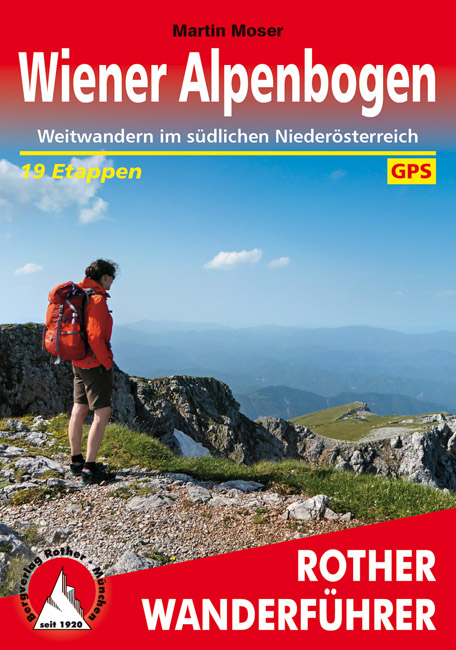
- Wandelgids Wiener Alpenbogen | Rother Bergverlag
- Duitstalige wandelgids van Wiener Alpenbogen met zeer goed beschreven wandelingen in de wandelgebieden. Redelijk kaartmateriaal, vooral de beschrijving van de route en de praktische info die er bij hoort is goed. Genussvolles Weitwandern vor den Toren Wiens: Der »Weg am Wiener Alpenbogen« lässt die herrliche Alpenlandschaft erleben, die sich... Read more
Netherlands
2022
Netherlands
2017
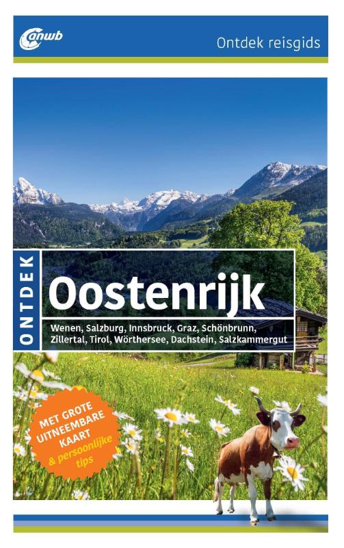
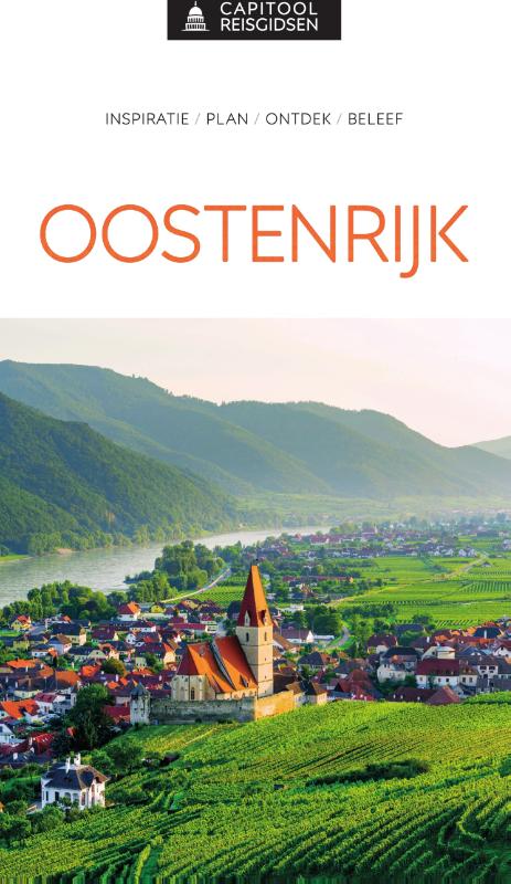
- Reisgids ANWB Ontdek Oostenrijk | ANWB Media
- Een nieuwe ANWB reisgids: deze titel is een vertaling van de Duitstalige Dumont reeks. Ze staan bekend als zeer degelijke en behoorlijk complete reisgisden in compact formaat. Met zowel veel achtergrondinformatie, maar ook veel tips over bezienswaardigheden en adressen voor bijvoorbeeld eten en drinken. Het boek is ook nog voorzien van leuke... Read more
Netherlands
2021
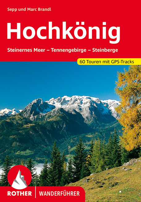
- Wandelgids Hochkönig | Rother Bergverlag
- Uitstekende wandelgids met een groot aantal dagtochten in dal en hooggebergte. Met praktische informatie en beperkt kaartmateriaal! Wandelingen in verschillende zwaarte weergegeven in rood/blauw/zwart. Das Alpenreich des Hochkönigs, mit 2941 Metern höchster Gipfel der Berchtesgadener Alpen, hat zwei grundverschiedene Gesichter: ein zahmes von... Read more
Netherlands
2014
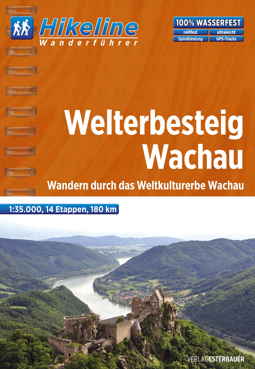
- Wandelgids Hikeline Wanderführer Welterbesteig Wachau | Esterbauer
- Goede handzame wandelgids met duidelijke kaarten en informatieve tekst. / Gedetailleerde wandelgidsen met ingetekende lange afstandsroute. Goede omschrijving van de route met tevens praktische informatie voor onderweg. Scheur- en watervast papier. An den steilen Hängen und Flussufern beidereits der Donau, auf einer Länge von rund 35 Kilometern,... Read more
Netherlands
2022
Netherlands
2017
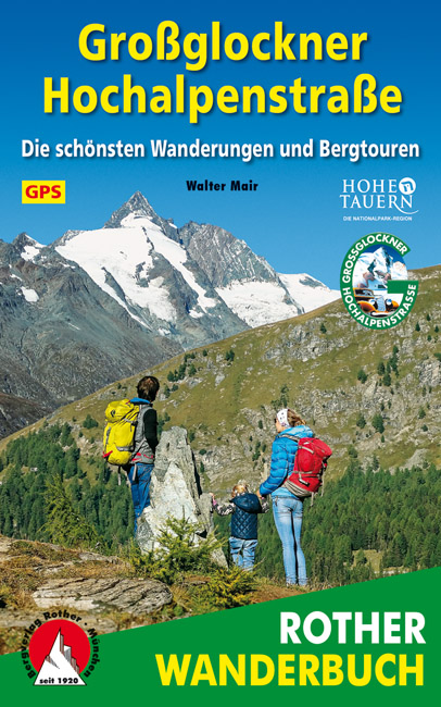
- Wandelgids Großglockner Hochalpenstraße | Rother Bergverlag
- De ‘Rother Wanderbücher’ behandelen telkens de 50 mooiste wandelingen, die variëren van eenvoudige kindvriendelijke wandelingen tot routes die aanzienlijk meer ervaring vereisen. Uitvoerige routebeschrijvingen, een aantrekkelijke lay-out met vele kleurenfoto’s; niets aan duidelijkheid te wensen gelaten hoogteprofielen, kaartjes met de... Read more

Netherlands
2018
- Reisgids Capitool Top 10 Wenen | Unieboek
- - Top 10 van onder andere de beste restaurants, de mooiste bezienswaardigheden en de leukste winkels - Met de uitneembare kaart vind je gemakkelijk de weg - De schitterende foto’s brengen de stad tot leven - Compact formaat, ideaal om mee te nemen - Diverse wandelroutes leiden je door de sfeervolle wijken van Wenen Top 10 Wenen De reisgids is... Read more

Netherlands
2021
- Wandelgids Arlberg - Paznaun | Rother Bergverlag
- Uitstekende wandelgids met een groot aantal dagtochten in dal en hooggebergte. Met praktische informatie en beperkt kaartmateriaal! Wandelingen in verschillende zwaarte weergegeven in rood/blauw/zwart. Zwischen den Allgäuer Alpen und der Silvretta liegt ein wahres Wanderparadies. Dabei darf man sich von den im Untertitel erwähnten Alpin-Zentren... Read more
Netherlands
2020
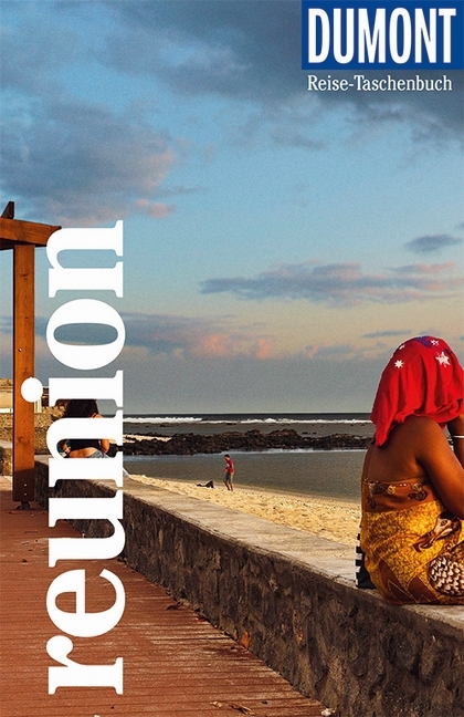
- Reisgids Reise-Taschenbuch Réunion | Dumont
- Daniela Eiletz-Kaube und Kurt Kaube sind in Österreich geboren, doch die ganze Welt ist ihr Zuhause. 2005 übersiedelten sie nach Tansania, 2007 führte sie der Zufall nach Réunion, wo sie viel länger als geplant verweilten. An Réunion fasziniert sie die ethnische Vielfalt, die abwechslungsreiche Natur, die unsagbar schönen Landschaften und die... Read more
Netherlands
2020
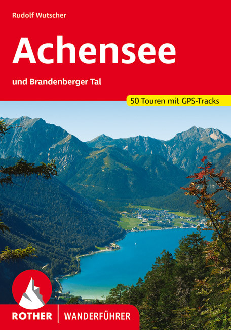
- Wandelgids 01 Achensee | Rother Bergverlag
- Uitstekende wandelgids met een groot aantal dagtochten in dal en hooggebergte. Met praktische informatie en beperkt kaartmateriaal! Wandelingen in verschillende zwaarte weergegeven in rood/blauw/zwart. Das Achenseegebiet blickt auf eine lange Tradition als Urlaubsregion zurück: Erster Erholungsort war wohl das Fürstenhaus zu Pertisau, das die... Read more
Karten

United Kingdom
- Also available from:
- Stanfords, United Kingdom

United Kingdom
- Carinthian Alps - Gailtal - Gitschtal - Nassfeld - Lesachtal - Weissensee - Upper Drautal F&B WK223
- Naturarena Kärnten - Gailtal - Gitschtal -Lesachtal - Weissensee - Oberes Drautal area of Carinthia presented at 1:50,000 in a series of contoured and GPS compatible outdoor leisure map from Freytag & Berndt with hiking and cycling routes, mountain huts, campsites and youth hostels, local bus stops, plus other tourist information.To see the... Read more

United Kingdom
- 68: Ausseerland - Ennstal 1:50, 000
- Goede wandelkaart met vrijwel alle topografische details en ingetekende routes. Ook met symbolen voor toeristische bezienswaardigheden, register. Berghutten duidelijk weergegeven. Gevaarlijke wandelroutes zijn goed herkenbaar. Inclusief een Duitstalig boekje met informatie en routesuggesties. KOMPASS-Wanderkarten enthalten alles Wissenswerte... Read more
Netherlands
Netherlands
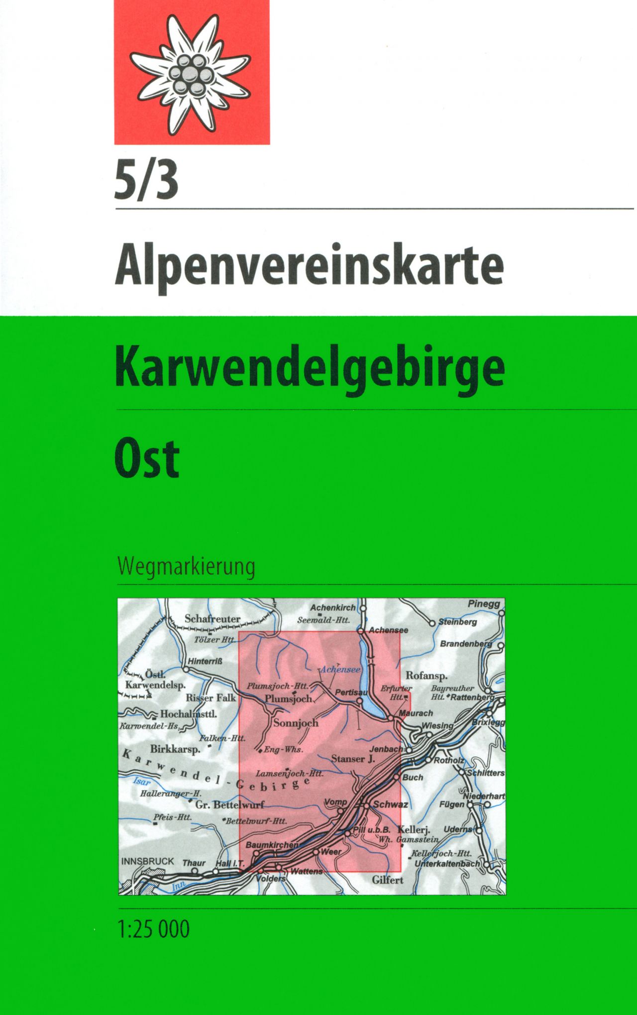
- Wandelkaart 05/3 Alpenvereinskarte Karwendelgebirge - Ost | Alpenverein
- De beste en meest gedetailleerde kaarten van met name de Oostenrijkse alpen: wandelroutes zijn naar zwaarte onderscheidend gemarkeerd, gletsjeroverschrijdingen staan aangegeven en de verschillende soorten hutten ingetekend. Met als ondergrond de topografische kaarten bieden ze een schat aan informatie voor elke beginnende en gevorderde... Read more
Netherlands
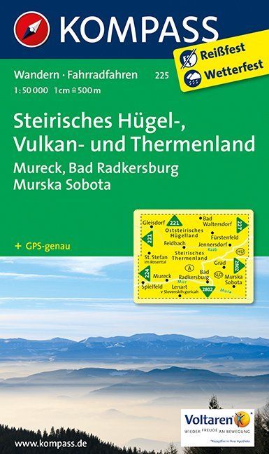
- Wandelkaart 225 Steirisches Hügel-, Vulkan- und Thermenland | Kompass
- Goede wandelkaart met vrijwel alle topografische details en ingetekende routes. Ook met symbolen voor toeristische bezienswaardigheden, register. Berghutten duidelijk weergegeven. Gevaarlijke wandelroutes zijn goed herkenbaar. GPS toepasbaar. Inclusief een Duitstalig boekje met informatie en routesuggesties. Destination: • Die Südoststeiermark... Read more
- Also available from:
- Stanfords, United Kingdom

United Kingdom
- Styria Hills, Volcano and Thermal Lands kompass 225
- Styria’s Volcanic Hills and Thermal Baths Land area of Austria on a detailed, GPS compatible map at 1:50,000 from Kompass with local and long-distance footpaths, cycling routes, accommodation, etc, printed on durable, waterproof and tear-resistant synthetic paper.KOMPASS HIKING & RECREATIONAL MAPS: this title is part of an extensive series... Read more
Netherlands
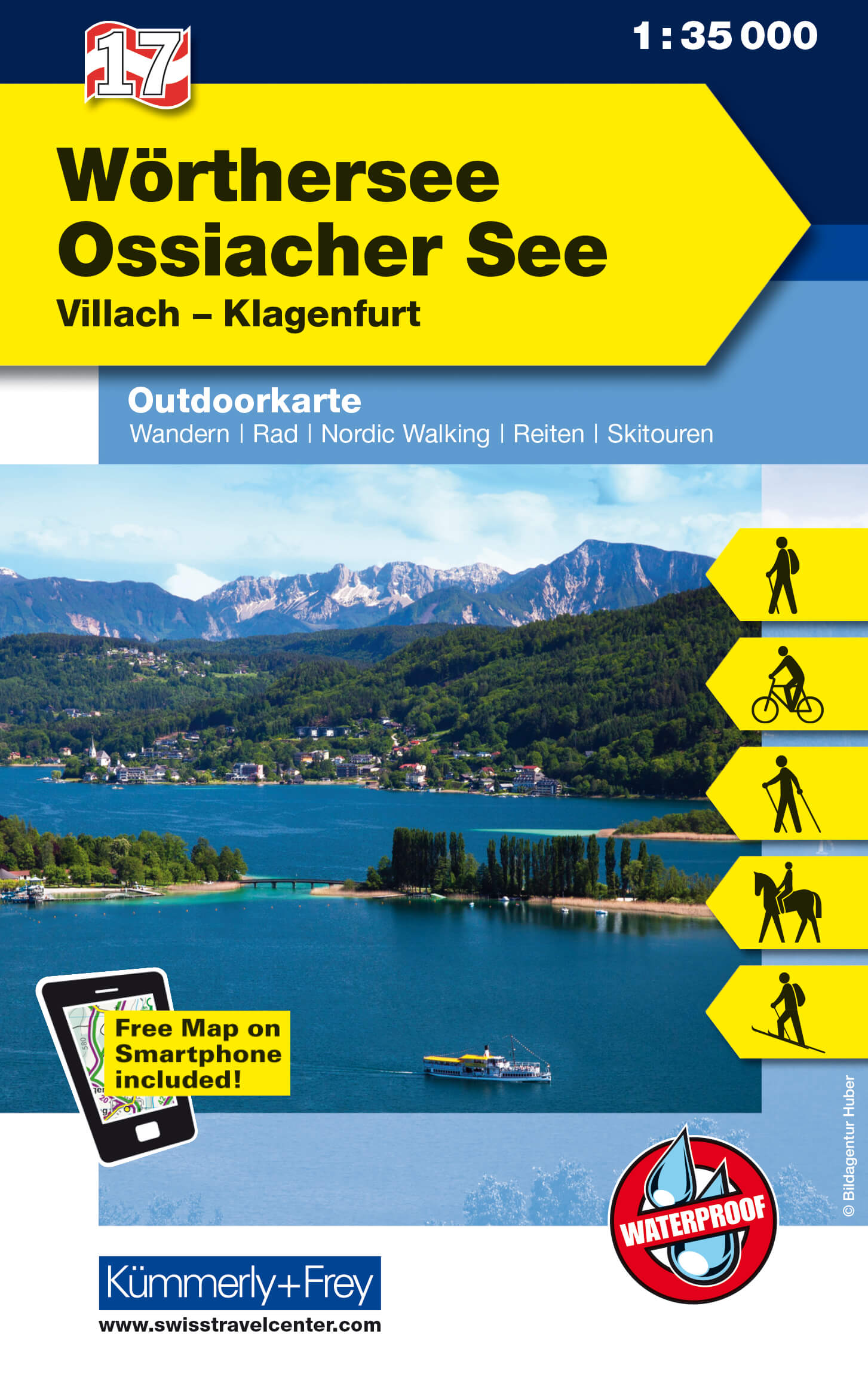
- Wandelkaart 17 Outdoorkarte AT Wörthersee - Ossiacher See | Kümmerly & Frey
- Wörthersee - Ossiacher See area of Carinthia at 1:35,000 on a GPS compatible, double-sided map from Kümmerly+Frey printed on sturdy, waterproof and tear-resistant synthetic paper; contoured, with hiking, cycling and ski routes, accommodation facilities, locations for other recreational activities, etc.Maps in the K+F recreational series... Read more
- Also available from:
- Stanfords, United Kingdom

United Kingdom
- Wörthersee - Ossiacher See K+F Outdoor Map 17
- Wörthersee - Ossiacher See area of Carinthia at 1:35,000 on a GPS compatible, double-sided map from Kümmerly+Frey printed on sturdy, waterproof and tear-resistant synthetic paper; contoured, with hiking, cycling and ski routes, accommodation facilities, locations for other recreational activities, etc.Maps in the K+F recreational series... Read more
Netherlands
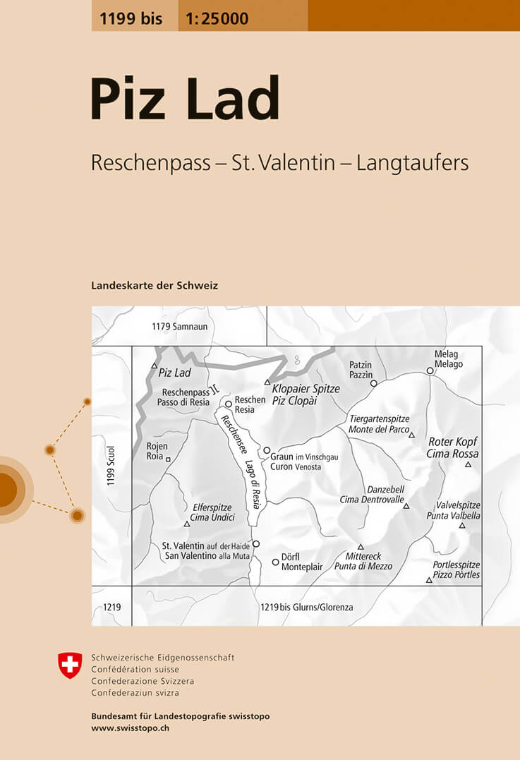
- Wandelkaart - Topografische kaart 1199bis Piz Lad | Swisstopo
- Map No. 1199 bis, Piz Lad, in the topographic survey of Switzerland at 1:25,000 from Bundesamt f Read more
- Also available from:
- Stanfords, United Kingdom

United Kingdom
- Piz Lad Swisstopo 1199bis
- Map No. 1199 bis, Piz Lad, in the topographic survey of Switzerland at 1:25,000 from Bundesamt für Landestopographie (swisstopo), covering the whole country on 247 small format sheets, with special larger maps published for popular regions including some titles now available in hiking versions.Highly regarded for their superb use of graphic... Read more
Netherlands
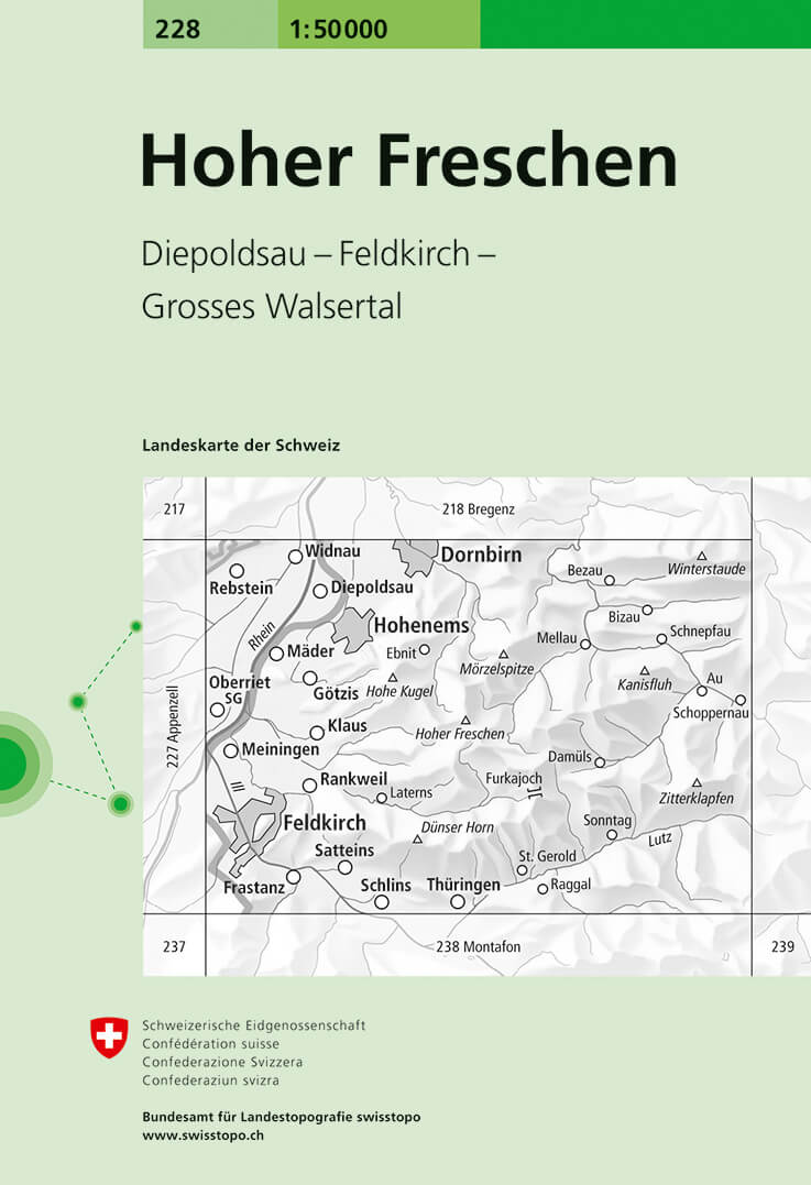
- Wandelkaart - Topografische kaart 228 Hoher Freschen | Swisstopo
- Hoher Freschen, map No. 228, in the standard topographic survey of Switzerland at 1:50,000 from Swisstopo, i.e. without the special overprint highlighting walking trails, local bus stops, etc, presented in Swisstopo Read more
- Also available from:
- Stanfords, United Kingdom

United Kingdom
- Hoher Freschen Swisstopo 228
- Hoher Freschen, map No. 228, in the standard topographic survey of Switzerland at 1:50,000 from Swisstopo, i.e. without the special overprint highlighting walking trails, local bus stops, etc, presented in Swisstopo’s hiking editions of the 50K survey. The map covers mainly Austria, extending east to Au.Highly regarded for their superb use of... Read more
Netherlands
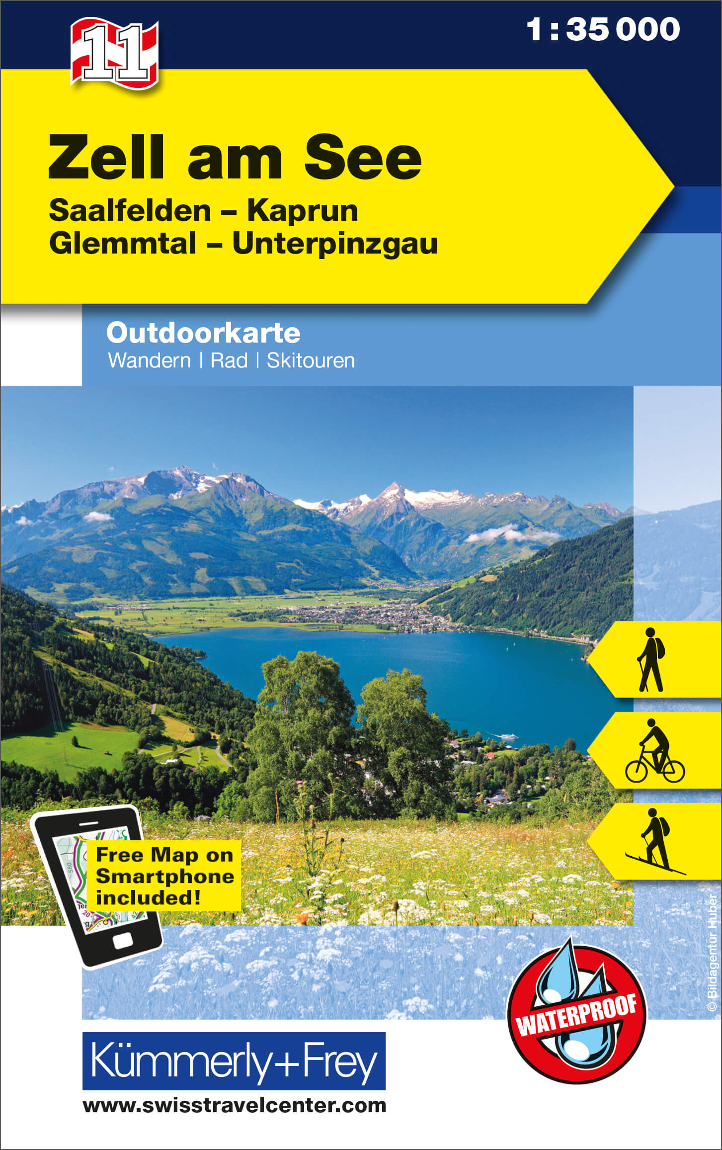
- Wandelkaart 11 Outdoorkarte AT Zell am See | Kümmerly & Frey
- Zell am See - Kaprun - Glemmtal - Unterpinzgau area of the Tyrol at 1:35,000 on a GPS compatible, double-sided map from Kümmerly+Frey printed on sturdy, waterproof and tear-resistant synthetic paper; contoured, with hiking, cycling and ski routes, accommodation facilities, locations for other recreational activities, etc.Maps in the K+F... Read more
- Also available from:
- Stanfords, United Kingdom

United Kingdom
- Zell am See - Kaprun - Glemmtal - Unterpinzgau K+F Outdoor Map 11
- Zell am See - Kaprun - Glemmtal - Unterpinzgau area of the Tyrol at 1:35,000 on a GPS compatible, double-sided map from Kümmerly+Frey printed on sturdy, waterproof and tear-resistant synthetic paper; contoured, with hiking, cycling and ski routes, accommodation facilities, locations for other recreational activities, etc.Maps in the K+F... Read more
Netherlands
Netherlands
2024